
Existed: 1961 – present Length 14.9 km | Constructed 1961 | |
 | ||
Counties | ||
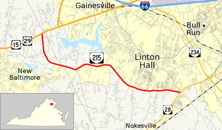
State Route 215 (SR 215) is a primary state highway in the U.S. state of Virginia. Known as Vint Hill Road, the state highway runs 9.26 miles (14.90 km) from U.S. Route 15 and US 29 at Buckland east to SR 28 near Bristow. SR 215 forms part of a connection between Warrenton and Manassas.
Contents
Map of VA-215, Virginia, USA
Route description
SR 215 begins at an intersection with US 15 and US 29 (Lee Highway) at Buckland just west of the Fauquier – Prince William county line. The state highway heads southeast parallel to the county line, then passes to the north of the Vint Hill Village community as it curves east and enters Prince William County. SR 215 passes through the hamlet of Greenwich and passes to the south of the suburban community of Linton Hall. The state highway reaches its eastern terminus at SR 28 (Nokesville Road) near Bristow.