
Existed: 1933 – present Length 2.78 km | Counties: Westmoreland Constructed 1933 | |
 | ||
East end: Washington's Birthplace County Westland County, Virginia | ||
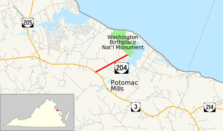
State Route 204 (SR 204) is a primary state highway in the U.S. state of Virginia. Known as Popes Creek Road, the state highway runs 1.73 miles (2.78 km) from SR 3 near Potomac Mills east to George Washington Birthplace National Monument in northwestern Westmoreland County.
Contents
Map of VA-204, Colonial Beach, VA 22443, USA
SR 204 is a Virginia Byway.
Route description
SR 204 begins at an intersection with SR 3 (Kings Highway) just north of Potomac Mills, the former site of a mill on Popes Creek. The state highway heads straight east-northeast through a forested area with intermittent farmland. As SR 204 approaches George Washington Birthplace National Monument, the state highway passes between fields and is flanked by rows of trees. The state highway reaches its eastern terminus at the entrance to the national monument, just east of which is a four-leg roundabout that contains in its center a replica of the Washington Monument.
Major intersections
The entire route is in Westmoreland County.