
Existed: c. 1970 – present Constructed 1970 | Length 9.99 km | |
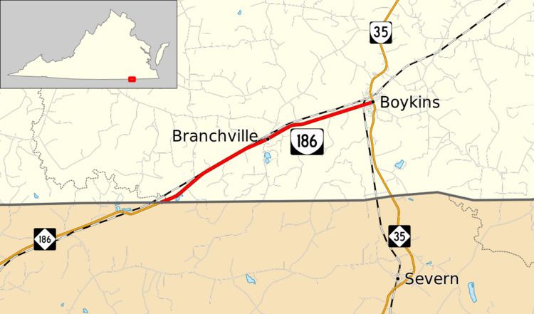 | ||
West end: NC 186 near Branchville | ||
State Route 186 (SR 186) is a primary state highway in the U.S. state of Virginia. The state highway runs 6.21 miles (9.99 km) from the North Carolina state line near Branchville, where the highway continues west as North Carolina Highway 186 (NC 186), east to SR 35 in Boykins.
Contents
Map of VA-186, Virginia, USA
Route description
SR 186 begins at the North Carolina state line southwest of Branchville; the highway continues southwest as NC 186 toward Garysburg. The state highway clips the southeastern corner of Greensville County before crossing the Meherrin River into Southampton County. SR 186 heads northeast as Hugo Road, which parallels CSX's Portsmouth Subdivision northeast to the town of Branchville. The state highway heads through Branchville as Broad Street then becomes Pittman Road between that town and Boykins. SR 186 enters the town of Boykins at its crossing of the North Carolina and Virginia Railroad just south of that railroad's wye junction with the CSX rail line. The state highway becomes Beaton Avenue for the final stretch to its eastern terminus at SR 35 (Main Street).