
Existed: 1933 – present Counties: Accomack Constructed 1933 | Length 5.97 km | |
 | ||
West end: US 13 / SR 614 in Painter | ||
Virginia state route 182
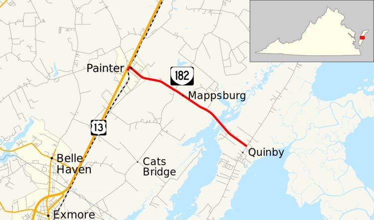
State Route 182 (SR 182) is a primary state highway in the U.S. state of Virginia. The state highway runs 3.71 miles (5.97 km) from U.S. Route 13 (US 13) in Painter east to SR 605 at Quinby in southern Accomack County.
Contents
- Virginia state route 182
- Map of VA 182 Painter VA 23420 USA
- Route description
- Major intersections
- References
Map of VA-182, Painter, VA 23420, USA
Route description
SR 182 begins at an intersection with US 13 (Lankford Highway) in the town of Painter. The state highway follows Main Street very briefly east of US 13, during which the highway intersects the Bay Coast Railroad. East of the rail line, SR 182 turns north onto Railroad Avenue, then veers east onto Edmunds Street. The state highway leaves town along Mappsburg Road, which the highway follows to the hamlet of Mappsburg. SR 182 continues east as Quinby Bridge Road, which crosses the Machipongo River on the namesake bridge. The state highway reaches its eastern terminus at SR 605, which heads north as Bradfords Neck Road and south as Upshur Neck Road through the village of Quinby on Upshur Bay.
Major intersections
The entire route is in Accomack County.