
Existed: 1933 – present Counties: Accomack Constructed 1933 | Length 4.15 km | |
 | ||
West end: SR 316 / SR 673 in Parksley | ||
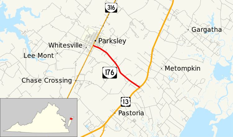
State Route 176 (SR 176) is a primary state highway in the U.S. state of Virginia. Known for most of its length as Parksley Road, the state highway runs 2.58 miles (4.15 km) from SR 316 in Parksley east to U.S. Route 13 (US 13) at Centerville in central Accomack County.
Contents
Map of VA-176, Parksley, VA 23421, USA
Route description
SR 176 begins at an intersection with SR 316 (Cassatt Avenue) in the center of the town of Parksley. Bennett Street continues west as SR 673 toward Justisville. SR 176 has a grade crossing of the Bay Coast Railroad immediately to the east of SR 316 and passes to the south of the Eastern Shore Railway Museum before exiting the town. The state highway follows Parksley Road southeast from the town limit to the route's eastern terminus at US 13 (Lankford Highway) in the hamlet of Centerville.
Major intersections
The entire route is in Accomack County.