
Existed: 1933 – present Constructed 1933 | Length 2.96 km | |
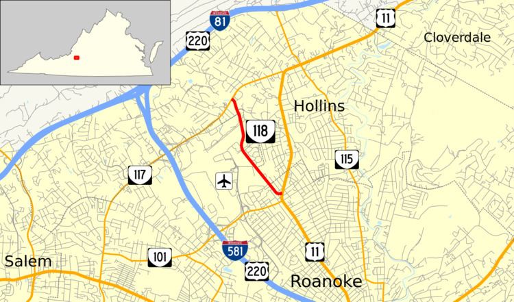 | ||
State Route 118 (SR 118) is a state highway in the U.S. state of Virginia. Known as Airport Road, the state highway runs 1.84 miles (2.96 km) from U.S. Route 11 (US 11) in Roanoke north to SR 117 in Hollins. SR 118 provides supplemental access to Roanoke Regional Airport, whose primary access road is Aviation Drive, which is more directly connected with SR 101, Interstate 581, and U.S. Route 220 in Virginia.
Contents
Map of VA-118, Roanoke, VA, USA
Route description
SR 118 begins at an intersection with US 11 (Williamson Road) just north of US 11's intersection with SR 101 (Hershberger Road). The state highway heads north as a two-lane road between a shopping center to the west and a residential area to the east. SR 118 continues through an industrial area to the east of Roanoke Regional Airport and intersects Municipal Road, which leads to Aviation Drive, the road that serves the airport terminal. The state highway curves northeast and descends into a tunnel that passes under the airport's east–west runway. At the north end of the tunnel, SR 118 enters Roanoke County, passes through a residential area, and reaches its northern terminus at SR 117 (Peters Creek Road) on the west side of Hollins.