
Country Honduras Villages 5 Population 2,574 (2015) | Department Lempira Area 36 km² Local time Monday 7:53 PM | |
 | ||
Weather 29°C, Wind S at 6 km/h, 61% Humidity | ||
Virginia ([birˈxinja]) is a municipality in the Honduran department of Lempira. Virginia is located in Lempira Honduras and shares a border with El Salvador. Many Virginians travel to El Salvador to do their shopping, because the Honduran cities are far away from Virginia.
Contents
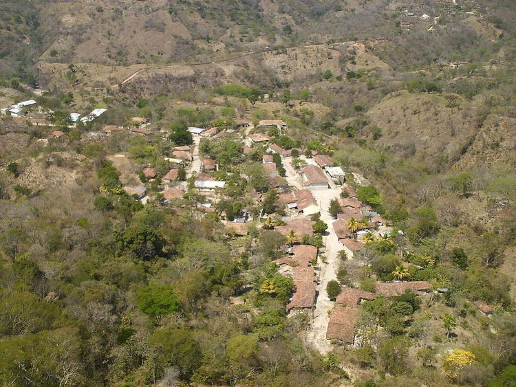
Map of Virginia, Honduras
It is one of the smallest municipalities of the Lempira department. It is 15 km or 30 minutes away from Mapulaca. And the best way to get there is via Gracias; observing all the warnings mentioned in previous articles.
History
It was founded back in 1830. In the national division of 1889 it was one municipality of Candelaria.
Geography
It is situated in a semi flat place and surrounded by many hills. The predominant vegetation corresponds to the sub tropical dry forest. In the municipality capital there are some inclined streets.
Boundaries
Its boundaries are:
Population
In Virginia, the cross-breed represents 80% of the population. The remaining portion is made up of the descendants of Lenca Indians, who live in the surrounding villages.
Tourism
As for the remaining 15 km, although this dirt road is not in the best condition, it is still an easy drive. A half-hour visit will be enough to see all there is to see in the municipality capital. For those who are interested in rural and quiet towns, this is a good place to visit. Surprisingly, the mobile phone signal from El Salvador is stronger than the Honduran signal. Since it is near the Lempa River, the local pastime is going there to bathe. The local holidays and festivals attract many visitors.