
Basin size 1,240 km (480 sq mi) Basin area 1,240 km² | Length 128 km Source elevation 300 m | |
 | ||
Cities | ||
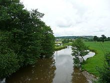
The Vire is a river in Normandy, France whose 128 km course crosses the départements of Calvados and Manche, flowing through the towns of Vire, Saint-Lô and Isigny-sur-Mer, finally flowing out into the English Channel. Its main tributaries are the Aure, the Elle and the Souleuvre.
Contents
Map of La Vire, France
The outflow of the Vire has been canalized and forms the port of Isigny-sur-Mer.
The poets of the Vire valley (Vau de Vire) are said to have given rise to vaudeville.
Places along the river:
Hydrology and water qualityEdit
The generally brownish waters of the Vire are moderately alkaline having been tested by Lumina Tech as pH 8.31. (Hogan, 2006) The river waters are relatively turbid, with a Secchi disc measurement of 12 centimetres.
Historical SignificanceEdit
At the turn of the 10th century, the territorial lands of the Kingdom of Brittany had been expanded up to the Vire by their king Alan I.