
Area rank 179 in Norway Area 620.6 km² Local time Monday 8:39 PM | Administrative centre Ølensjøen Demonym(s) Vindafjording Population 8,765 (2015) | |
 | ||
Weather 8°C, Wind S at 18 km/h, 79% Humidity Points of interest Frønsdal, Ilsvåg, Romsa Islands, Hutlingetong, Strand, Kallrak | ||
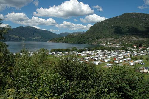
Vindafjord is a municipality in Rogaland county, Norway. It is part of the traditional district of Haugaland. Since 2005, the administrative centre of the municipality has been the village of Ølensjøen, prior to that time it was the village of Sandeid. Other villages in the municipality include Bjoa, Imslandsjøen, Ølensvåg, Skjold, Vats, Vikebygd, and Vikedal. The municipality is centered on the Vindafjorden and Sandeidfjorden in the east and it lies north and east of the Skjoldafjorden in the west.
Contents
- Map of Vindafjord Norway
- General information
- Name
- Coat of arms
- Churches
- Government
- Municipal council
- Geography
- References
Map of Vindafjord, Norway
General information
Vindafjord was established as a new municipality on 1 January 1965 after a major municipal merger that resulted from the work of the Schei Committee. The municipality of Sandeid and parts of the municipalities of Vats, Imsland, Skjold, and Vikedal. Initially, Vindafjord had 4,616 residents. On 1 January 1969, the Sponevik farm (population: 6) was transferred from Vindafjord to the neighboring municipality of Tysvær. Then on 1 January 1978, the Vormestrand area along the southern shore of the Vindafjorden (population: 13) was transferred to neighboring Suldal municipality.
On 1 January 2006, Vindafjord merged with the neighboring municipality of Ølen (population: 3,420). Ølen had transferred from Hordaland county to Rogaland county 2002. After the merger, the municipal centre was moved from Sandeid to the village of Ølensjøen, which had been the administrative centre of Ølen.
Name
The municipality (created in 1965) is named after the Vindafjorden, a fjord that runs through the eastern part of the municipality. The first element is probably derived from the verb vinda which means "turn" or "twist" referring to the sharp turn of the fjord at Dragneset.
Coat-of-arms
The coat-of-arms were granted on 10 March 2006, shortly after the merger of Ølen with Vindafjord. The new arms are a mix of the old arms of the two municipalities before the merger. The swirling design is taken from the old coat-of-arms of Ølen and the colours (red and silver/white) are from the old arms of Vindafjord. The swirling design of the arms show in a symbolized way all the roads that come together in the municipality. The municipality thus is an important centre of trade.
Churches
The Church of Norway has eight parishes (sokn) within the municipality of Vindafjord. It is part of the Haugaland deanery in the Diocese of Stavanger.
Government
All municipalities in Norway, including Vindafjord, are responsible for primary education (through 10th grade), outpatient health services, senior citizen services, unemployment and other social services, zoning, economic development, and municipal roads. The municipality is governed by a municipal council of elected representatives, which in turn elect a mayor.
Municipal council
The municipal council (Kommunestyre) of Vindafjord is made up of 25 representatives that are elected to every four years. For 2011–2015, the party breakdown is as follows:
Geography
The municipality of Vindafjord lies south of the Hardangerfjorden and north of the Skjoldafjorden and Vindafjorden. The Sandeidfjorden flows through the municipality also. The lake Vatsvatnet lies in the central part of the municipality. The municipality sits near the base of the Haugalandet peninsula, connecting the mainland to the city of Haugesund on the western end of the peninsula. The European route E134 highway runs through the municipality.