
Local time Monday 5:47 PM | Area 26.13 km² | |
 | ||
Intercommunality Fercher - Pays florentais Weather 19°C, Wind N at 10 km/h, 37% Humidity | ||
Villeneuve-sur-Cher is a commune in the Cher department in the Centre region of France.
Contents
Map of 18400 Villeneuve-sur-Cher, France
Geography
An area of forestry and farming comprising the village and a couple of hamlets situated on the banks of the river Cher, about 9 miles (14 km) southeast of Bourges, at the junction of the D16 with the D35 and D27 roads.
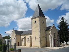
Sights
References
Villeneuve-sur-Cher Wikipedia(Text) CC BY-SA