
Area 28.15 km² | Intercommunality Haute Tarentaise Population 368 (1999) | |
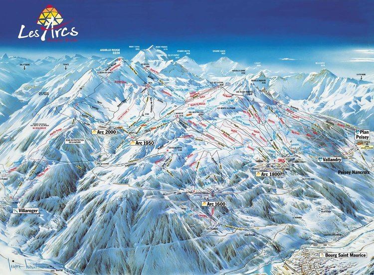 | ||
Ski chalet villaroger in the world famous ski area of les arcs paradiski
Villaroger is a commune in the Savoie department in the Auvergne-Rhône-Alpes region in south-eastern France. It is situated in the upper Tarentaise Valley, between Bourg-Saint-Maurice and Tignes.
Contents
- Ski chalet villaroger in the world famous ski area of les arcs paradiski
- Map of 73640 Villaroger France
- References
Map of 73640 Villaroger, France
The commune of Villaroger extends from 850m at the river Isère up to 3779m at the Mont Pourri. Villaroger is made up of several hamlets, the main village being at 1075m. The name Villaroger comes from “Villarium Ogerii” which indicates the existence of a villa during the Middle Ages, which belonged to a certain Oger or Ogier, a family name particularly common among the French during the 5th and the 6th centuries.
For years the main source of income has been farming and cheese production. In addition to these traditional ways of life, tourism now plays an important part. Villaroger has been linked to Les Arcs by a three man chairlift since 1982. Its geographical situation and landscape lends itself to numerous winter and summer activities.