
Time zone CET (UTC+1) Postal code 42030 | Elevation 684 m (2,244 ft) Area 167.9 km² Local time Monday 1:59 PM | |
 | ||
Frazioni Asta, Carniana, Carù,Case Zobbi, Cerrè Sologno,Cervarolo, Civago,Coriano, Costabona,Febbio, Gazzano,Gova, La Rocca,Lusignana, Minozzo,Morsiano, Monteorsaro,Novellano, Poiano,Primaore, Razzolo,Santonio, Secchio,Sologno, Tizzola Weather 14°C, Wind N at 18 km/h, 57% Humidity | ||
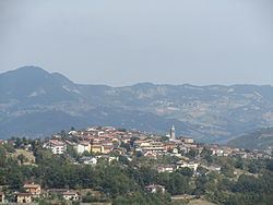
Villa Minozzo is a comune (municipality) in the Province of Reggio Emilia in the Italian region Emilia-Romagna, located about 70 kilometres (43 mi) west of Bologna and about 40 kilometres (25 mi) southwest of Reggio Emilia.
Contents
Map of 42030 Villa Minozzo, Province of Reggio Emilia, Italy
Geography
Its territory includes the ski resort of Febbio and the highest peak in the province, Monte Cusna at 2,121 metres (6,959 ft) above sea level. Through the frazione of Civago and the Forbici Pass, elevation 1,574 metres (5,164 ft), the Garfagana can be reached. Villa Minozzo is the biggest municipality in the province of Reggio Emilia, after Reggio Emilia itself.
References
Villa Minozzo Wikipedia(Text) CC BY-SA