
Basin countries Russia Max. width 55 km (34 mi) | Max. length 104 km (65 mi) | |
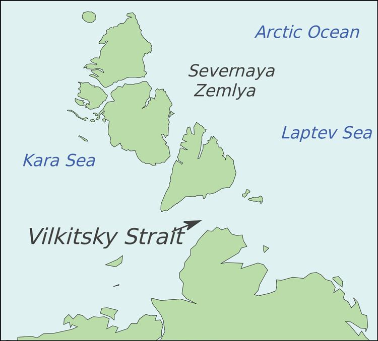 | ||
Vilkitsky Strait (Russian: Пролив Вилькицкого) is a strait between the Taimyr Peninsula and Bolshevik Island in the Severnaya Zemlya archipelago. The strait connects the Kara and Laptev Seas.
Contents
- 31 july anchoring nordenshel da archipelago just at the start of the vilkitsky strait
- Geography
- References
31 july anchoring nordenshel da archipelago just at the start of the vilkitsky strait
Geography
The length of the Vilkitsky Strait is 104 km, the width – approx. 55 km, and the depth – between 32 and 210 m. It is covered with drifting ice during winter. The strait was discovered in 1913 by a Russian hydrographic expedition led by Boris Vilkitsky and then named after him in 1918.
The Vilkitsky Strait is the northernmost strait in Russia's Northern Sea Route.
The Geiberg Islands cover the western entrance to the Vilkitski Strait from the east and the Firnley Islands cover it from the south-west. To the north lies Cape Neupokoyev, the southernmost point of Bolshevik Island. The shores on the side of the Taymyr Peninsula are covered with tundra vegetation and scattered stones. The northern coast is higher and falls to the south. The rivers that flow into the Vilkitsky Strait from the continental side are not significant. They are shallow and unsuitable for navigation.