
Country Colombia Subregion Urabá Area 1,780 km² | Elevation 12 m (39 ft) Local time Monday 2:42 AM | |
 | ||
Time zone Colombia Standard Time (UTC-5) Weather 25°C, Wind S at 5 km/h, 94% Humidity | ||
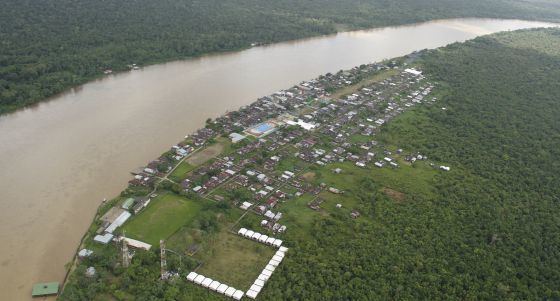
Vigía del Fuerte is a town and municipality in the Colombian department of Antioquia. The town is on the eastern bank of the Atrato River, which is locally the boundary between the Antioquia and Chocó Departments of Colombia.
Contents
Map of Vig%C3%ADa del Fuerte, Bojay%C3%A1, Choc%C3%B3, Colombia
The town is served by Vigía del Fuerte Airport.
Armed conflict
As of 2013, FARC rebels of the 57th and 34th fronts Northwestern Bloc of the FARC-EP are present in the municipality. On October 11th 2013, presumed FARC rebels attacked the municipality's airport, destroying an aircraft in the process.
References
Vigía del Fuerte Wikipedia(Text) CC BY-SA