
Country United States Incorporated 1833 Elevation 3 m Population 271 (2013) | State Maryland Founded 1706 Time zone Eastern (EST) (UTC-5) Zip code 21869 Local time Monday 12:57 AM | |
 | ||
Weather 9°C, Wind SW at 5 km/h, 73% Humidity | ||
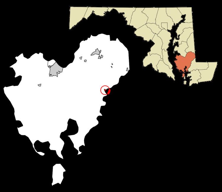
Vienna is a town in Dorchester County, Maryland, United States. The population was 271 at the 2010 census.
Contents
- Map of Vienna MD 21869 USA
- History
- Geography
- 2010 census
- 2000 census
- Major highways
- Navigable rivers
- Public transportation
- Notable people
- References
Map of Vienna, MD 21869, USA
History
Vienna was founded in 1706. It thrived on trade, shipbuilding and tobacco farming. The wreck of a 45-foot cargo ship that was likely built at a small shipyard or plantation in Maryland was found in 2015 under the US 50 Bridge over the Nanticoke River. Charring suggests it was torched by British sympathizers in the 1780s. The British raided the town repeatedly during the American Revolutionary War, and again during the War of 1812. This led to the building of a wall across the city's waterfront on the Nanticoke River. This wall is in ruins today. Handsell was listed on the National Register of Historic Places in 2008.
Vienna was incorporated in 1833.
Geography
Vienna is located at 38°29′7″N 75°49′37″W (38.485152, -75.827020).
According to the United States Census Bureau, the town has a total area of 0.19 square miles (0.49 km2), all of it land.
2010 census
As of the census of 2010, there were 271 people, 115 households, and 71 families residing in the town. The population density was 1,426.3 inhabitants per square mile (550.7/km2). There were 143 housing units at an average density of 752.6 per square mile (290.6/km2). The racial makeup of the town was 90.8% White, 7.0% African American, 0.7% from other races, and 1.5% from two or more races. Hispanic or Latino of any race were 0.7% of the population.
There were 115 households of which 27.0% had children under the age of 18 living with them, 46.1% were married couples living together, 11.3% had a female householder with no husband present, 4.3% had a male householder with no wife present, and 38.3% were non-families. 27.8% of all households were made up of individuals and 11.3% had someone living alone who was 65 years of age or older. The average household size was 2.36 and the average family size was 2.87.
The median age in the town was 46.9 years. 19.9% of residents were under the age of 18; 4.8% were between the ages of 18 and 24; 22.8% were from 25 to 44; 28.7% were from 45 to 64; and 23.6% were 65 years of age or older. The gender makeup of the town was 46.9% male and 53.1% female.
2000 census
As of the census of 2000, there were 280 people, 120 households, and 81 families residing in the town. The population density was 1,519.2 people per square mile (600.6/km²). There were 138 housing units at an average density of 748.8 per square mile (296.0/km²). The racial makeup of the town was 90.71% White, 5.36% African American, 0.36% Native American, 1.79% Asian, and 1.79% from two or more races. Hispanic or Latino of any race were 0.36% of the population.
There were 120 households out of which 28.3% had children under the age of 18 living with them, 50.8% were married couples living together, 11.7% had a female householder with no husband present, and 32.5% were non-families. 30.0% of all households were made up of individuals and 16.7% had someone living alone who was 65 years of age or older. The average household size was 2.33 and the average family size was 2.85.
In the town, the population was spread out with 22.9% under the age of 18, 5.0% from 18 to 24, 24.6% from 25 to 44, 24.6% from 45 to 64, and 22.9% who were 65 years of age or older. The median age was 42 years. For every 100 females there were 80.6 males. For every 100 females age 18 and over, there were 77.0 males.
The median income for a household in the town was $34,886, and the median income for a family was $46,250. Males had a median income of $28,542 versus $20,313 for females. The per capita income for the town was $18,082. About 4.7% of families and 4.5% of the population were below the poverty line, including 9.4% of those under the age of eighteen and 1.7% of those sixty five or over.
Major highways
Vienna is traversed by several Delmarva highways:
Navigable rivers
Vienna is on the north bank of the Nanticoke River.
Public transportation
Vienna is accessible by the Delmarva Community Transit commuter bus service.