
Country South Africa District Pixley ka Seme Established 1844 Local time Monday 2:34 AM | Province Northern Cape Municipality Ubuntu Postal code (street) 7070 Area code 053 | |
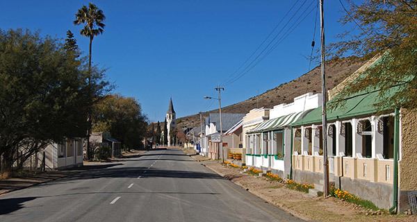 | ||
Victoria West is a town in the central Karoo region of South Africa's Northern Cape province.
Contents
Map of Victoria West, 7070, South Africa
History
The town was laid out on the bank of the Brakrivier watercourse in 1843, when the Dutch Reformed Church bought the farm Zeekoegat from a local farmer. It was named Victoria in 1844, after Queen Victoria, though amended to Victoria West in 1855 to distinguish it from an Eastern Cape district. The Cape Government Railways oversaw a massive expansion in the Cape Colony's railway system in the 1870s, though the route to Victoria West was only completed in 1881. The railway connection spurred economic development and the town's demographic growth over the following decades.
Government and Infrastructure
It is situated on the main N12 route, at an elevation of 1,300 metres (4,300 ft). It is the seat of the Ubuntu Local Municipality within the Pixley ka Seme District Municipality.
The town has a small airport (ICAO: FAVW), used only by light aircraft, but until the 1970s when they stopped operating piston engined airliners such as the Douglas DC-3, it was a refueling stop for South African Airways between Cape Town and destinations to the north.