
Country Thailand Time zone ICT (UTC+7) Area 543.5 km² Province Surat Thani Province | Amphoe established 1992 Postal code 84180 Population 15,125 (2013) Geocode 8419 | |
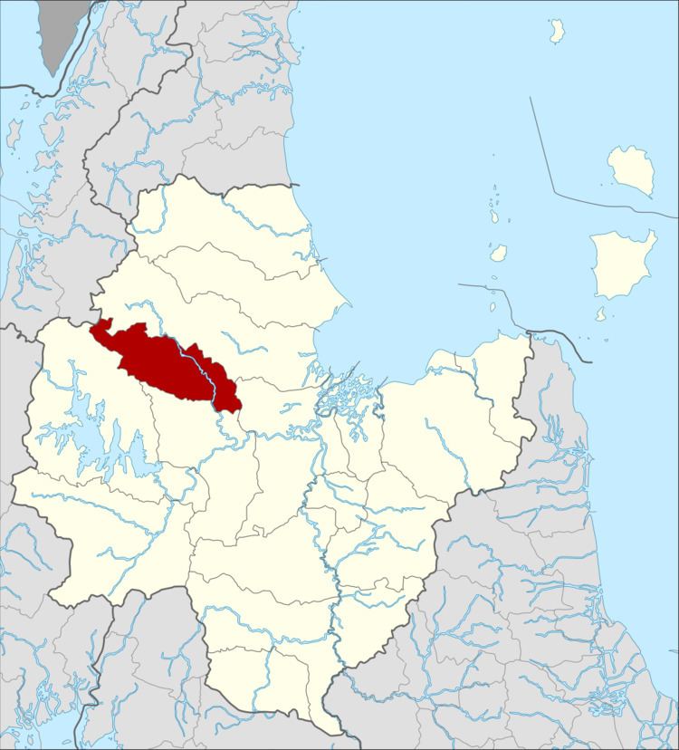 | ||
Vibhavadi is a district (amphoe) in the west of Surat Thani Province, southern Thailand.
Contents
- Map of Vibhavadi District Surat Thani Thailand
- Geography
- History
- Temples
- Central administration
- Local administration
- References
Map of Vibhavadi District, Surat Thani, Thailand
Geography
Neighboring districts are (from north clockwise) Tha Chang, Phunphin, Khiri Rat Nikhom, and Ban Ta Khun.
The district is in the hills of the Phuket mountain range, with part of the district being protected in the Khlong Yan Wildlife Sanctuary and the Kaeng Krung National Park.
History
The minor district (king amphoe) was created on 22 April 1992 by splitting off two tambon from Khiri Rat Nikhom district. It is named after Princess Vibhavadi Rangsit, who was killed in 1977 when rebels shot down her helicopter in eastern Surat Thani Province.
Following a decision of the Thai government on 15 May 2007, all of the 81 minor districts were upgraded to full districts on 24 August.
Temples
There are three Buddhist temples in the district, all of the Mahayana branch.
Central administration
The district Vibhavadi is subdivided into 2 subdistricts (tambon), which are further subdivided into 31 administrative villages (muban).
Local administration
There are 2 subdistrict administrative organizations (SAO) in the district: