- elevation 170 m (558 ft) Length 67 km | - elevation 306 m (1,004 ft) - average 6.81 m/s (240 cu ft/s) Area 672 km² | |
 | ||
- left Irance, Renon, distributary Petit Veyle - right Menthon, Bief de Pommier, Poches stream | ||
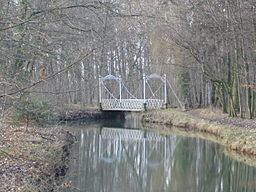
The Veyle (French: la Veyle) is a 66.9 km (41.6 mi) long river in the Ain département, eastern France. Its source is in Chalamont. It flows generally northwest. It is a left tributary of the Saône into which it flows between Grièges and Crottet, near Mâcon.
Contents
Map of La Veyle, France
Communes along its courseEdit
This list is ordered from source to mouth:
References
Veyle Wikipedia(Text) CC BY-SA
