
Counties: Vanderburgh | Length 2.7 km | |
 | ||
Tourist
routes: Ohio River Scenic Byway West end: Riverside Drive in Evansville East end: I-69 / US 41 in Evansville County Vanderburgh County, Indiana | ||
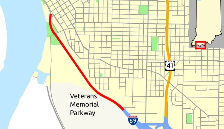
The Veterans Memorial Parkway is a four-lane parkway in the southwestern section of the state of Indiana. Running for about 1.7 miles (2.7 km) in a general northwest-southeast direction, connecting Downtown Evansville to Interstate 69 (I-69). The highway is entirely within Vanderburgh County and the City of Evansville.
Contents
Map of Veterans Memorial Pkwy, Evansville, IN, USA
Route description
Veterans Memorial Parkway begins at an continuation of Riverside Drive, when Riverside Drive turns southeast and Veterans Memorial Parkway continues towards the south. Veterans Memorial Parkway parallels the Ohio River as a four-lane divided parkway. The road curves towards the southeast passing Sunset Park and passes through a traffic light with Shawnee Drive/Waterworks Road. After the traffic light the road passes through a wooded area before ending at the beginning of Interstate 69. In 2013 the traffic count along Veterans Memorial Parkway shows that 8,256 vehicles travel the highway, southeast of Shawnee Drive, on average each day.
Major intersections
The entire route is in Evansville, Vanderburgh County.