
Existed: 1971 – present Constructed 1971 | Length 22.81 km | |
 | ||
East end: US 4 Bus. in West Rutland | ||
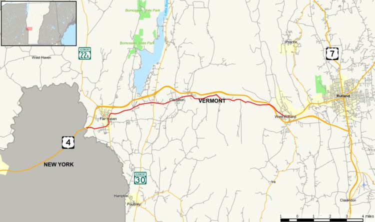
Vermont Route 4A is an east–west state highway in Rutland County, Vermont, United States. It runs from Fair Haven to West Rutland. VT 4A was the former alignment of U.S. Route 4 before it was relocated to an expressway.
Contents
Map of VT-4A, Vermont, USA
Route description
VT 4A begins at exit 1 of a four-lane U.S. Route 4 and goes into Fair Haven. It joins up with VT 22A and forms a brief concurrency in the center of town. The route then goes through the towns of Castleton (where it is known as Main Street and goes past Castleton University), Ira and West Rutland. The route ends at U.S. Route 4 Business in West Rutland.
Major intersections
The entire route is in Rutland County.
References
Vermont Route 4A Wikipedia(Text) CC BY-SA