
 | ||
Sitting on the rock in the verkhoyansk range in yakutia siberia russia
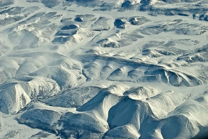
The Verkhoyansk Range (Russian: Верхоянский хребет, Verchojanskij chrebet; Yakut: Үөһээ Дьааҥы сис хайата, Üöhee Caañı sis xayata) is a mountain range of eastern Siberia spanning roughly 1000 km (600 mi.) across the Sakha Republic. It forms a vast arc between the Lena and Aldan rivers to the west and the Yana River to the east. It rises to c. 2,480 m (8,150 ft) in the south. There are coal, silver, lead, and zinc deposits. It lies just west of the boundary of the Eurasian and the North American tectonic plates.
Contents
- Sitting on the rock in the verkhoyansk range in yakutia siberia russia
- Map of Verkhoyansk Range Sakha Republic Russia 678585
- References
Map of Verkhoyansk Range, Sakha Republic, Russia, 678585
The world's lowest temperatures for inhabited places have been recorded in this region, and there is quite deep snow cover for most of the year. During the Last Glacial Maximum the range contained extensive glaciers, and the scenery in the summer is typical of "alpine" mountains.