
Length 166 km | ||
 | ||
Main source Alpes-de-Haute-Provence2,819 m (9,249 ft) Progression Durance→ Rhône→ Mediterranean Sea | ||
The Verdon is a 166-kilometre (103 mi) long river] in south-eastern France, left tributary of the Durance. Its source is at an elevation of 2,819 metres (9,249 ft), in the south-western Alps (Alpes-de-Haute-Provence), between the col d'Allos and the Trois Eveches mountain, south of Barcelonnette. It flows south-west through the following départements and towns:
Map of Verdon, France
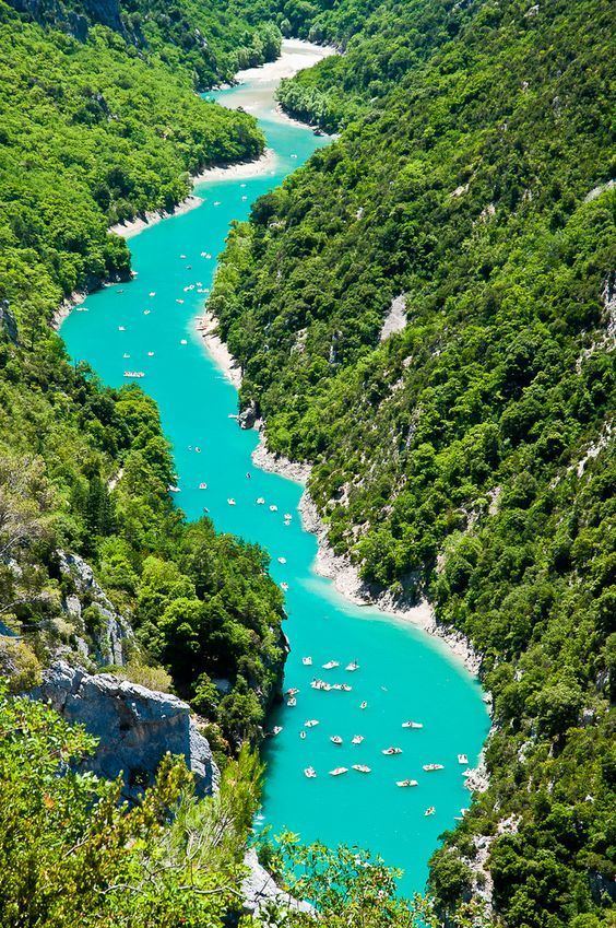
The Verdon flows through several artificial lakes, before flowing into the river Durance near Vinon-sur-Verdon, south of Manosque. The Verdon is best known for its impressive canyon: the Verdon Gorge. This limestone canyon, also called the "Grand Canyon of Verdon", 20 kilometres (12 mi) long and more than 300 metres (980 ft) deep, is a popular climbing and sight-seeing area. The name comes from the green appearance of the waters of the river, in the canyon.