
Established 1866 Area 57.47 km² Local time Sunday 6:19 AM PO box 2710 | Municipality Ventersdorp Postal code (street) 2710 Population 22,073 (2011) Area code 018 | |
 | ||
Weather 18°C, Wind N at 18 km/h, 54% Humidity | ||
Ventersdorp is a town in Dr Kenneth Kaunda District Municipality, North West Province, South Africa. It is the seat of Ventersdorp Local Municipality. The town's population is 4,200 and the nearby township of Tshing has a population of nearly 17,900.
Contents
Map of Ventersdorp, South Africa
History
The town grew around a Dutch Reformed Church that was established in 1866. The town was named after Johannes Venter who owned the land the church was built on.
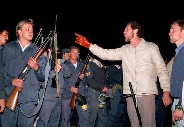
The Afrikaner nationalist Eugène Terre'Blanche was born in Ventersdorp, and the town is the base of the Afrikaner Weerstandsbeweging (AWB), the far-right secessionist political organisation and former paramilitary group which Terre'Blanche founded.
Racial segregation
The township of Tshing houses most of the town's blacks and coloureds. The township's secondary school of 1,000 pupils is still 100% black without a single white teacher.
The Ventersdorp High School has changed quite dramatically, with non-white students attending since 1995. These students are mostly Afrikaans speaking coloured residents of the smaller township Toevlug. Ventersdorp youth are bedevilled by alcoholism and unemployment. Ventersdorp has a great central location, making it easier to access more prominent urban towns such as Klerksdorp, Lichtenburg, Potchefstroom and Rustenburg.
The Tshing township has a diamond mine nearby: a town councillor owned it in the early 1990s. Tshing Location has one High school ( Thuto Boswa High School)