
Elevation 1,757 m (5,764 ft) Parent range Dinaric Alps | Location Croatia Range Dinaric Alps | |
Similar Plitvice Lakes National, Zrmanja, Krka National Park, Dinaric Alps, Mljet | ||
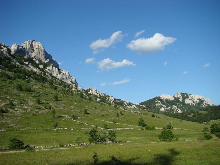
Amazing croatia from the sky in 4k velebit mountains
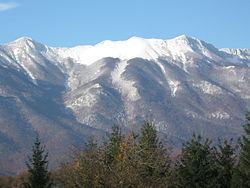
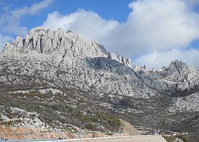
Velebit ([v̞ɛlɛ̌bit]; Italian: Alpi Bebie) is the largest though not the highest mountain range in Croatia. Its highest peak is the Vaganski vrh at 1,757 m.
Contents
- Amazing croatia from the sky in 4k velebit mountains
- Zavi an velebit mountain croatia
- The regions
- Peaks and areas of Velebit
- The caves
- Velebit in literature
- References
The range forms a part of the Dinaric Alps and is located along the Adriatic coast, separating it from Lika in the interior. Velebit begins in the northwest near Senj with the Vratnik mountain pass and ends 145 km to the southeast near the source of the Zrmanja river northwest of Knin.
Major mountain passes on Velebit include the aforementioned Vratnik or Senjsko bilo at 694 m.a.s.l., where the Josephina connects Senj with Josipdol; Oštarijska vrata at 928 m.a.s.l. that connects Karlobag and Gospić; and Prezid at 766 m.a.s.l. that connects Obrovac and Gračac.
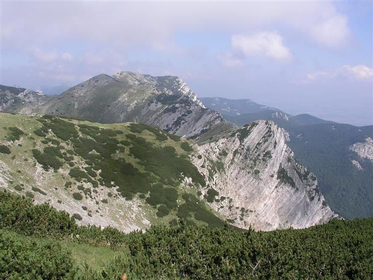
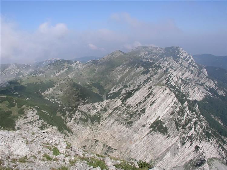
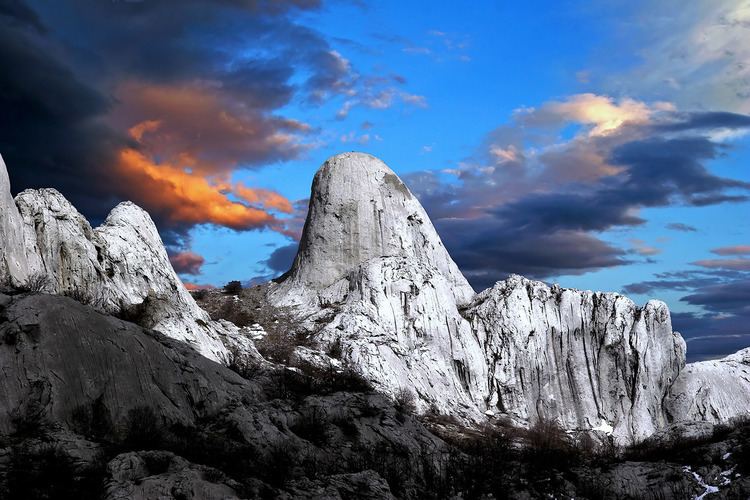
The important characteristic of Velebit are its simple, solid form, stiff cliffs, and the nakedness of seaward side and the wood-covered slopes of the Lika side. The basic geological characteristic of the mountains is karst; flora and fauna are abundant. The most popular spots on Velebit are: the peak of Vučjak, above Zavižan, the botanical gardens on Zavižan, Rožanski kukovi, Štirovača and the Paklenica National Park.
The Croatian Meteorological and Hydrological Service has a permanent measurement station at Zavižan.
Zavi an velebit mountain croatia
The regions
Velebit is usually divided into four regions:
Velebit as a whole is a nature park, from which two national parks have been carved out: Paklenica and Sjeverni Velebit.
A further category of even more careful nature preservation exists within Sjeverni Velebit, the special reservation Hajdučki i Rožanski Kukovi, under the highest nature protection available in Croatia. Officially no human activity is allowed there (except research). These are the mostly still unexplored and wild places and probably will stay that way in the future.
A pathway called Premužićeva staza (Premužić's pathway) leads through the northern and middle parts of Velebit. This pathway was built between 1930 and 1933 and it connects northern and southern Velebit. Its length is 57 kilometres (35 mi). Many parts of Velebit would not be reachable without it. The Velebit mountains are transversed by the A1 through the Sveti Rok Tunnel.
Peaks and areas of Velebit
Around 70 peaks exceed 1600 m.
The caves
There are hundreds of "holes" on Velebit. It has the largest and deepest caves in Croatia. The three-part "Lukina jama" cave is 1392 m deep, making it one of the deepest caves in the world, and the deepest in southeast Europe, while the "Slovačka jama" is 1320 m. What makes it unique is that it is completely vertical, steepest in the world. At the bottom of the pothole is a water course or siphon with branches that are still unexplored. A kind of leech was discovered in the pothole, which has been ascertained to represent a new species, genus and family; it has been named Erpobdella mestrovi.
List of potholes on Velebit deeper than 500 m:
- Lukina Jama, 1392 m, Hajdučki Kukovi - North Velebit
- Slovačka Jama, 1320 m, Rožanski Kukovi - North Velebit
- Velebita, 941 m, Rožanski Kukovi - North Velebit
- Meduza, 679 m, Rožanski Kukovi - North Velebit
- Patkov Gušt, 553 m, Hajdučki Kukovi - North Velebit
- Ledena Jama, 536 m, Lomska Duliba - North Velebit
- Ponor na Bunovcu, 534 m, Bunovac - South Velebit
- Jama Olimp, 531 m, Hajdučki Kukovi - North Velebit
- Lubuška Jama, 521 m, Hajdučki Kukovi - North Velebit
It is also home to Degenia velebitica, an endemic and protected species of plant in the mustard family discovered in 1907 by the Hungarian botanist Árpád von Degen.
The imposing nature of the Velebit mountain has made it something of a national symbol in Croatian folklore. There is a patriotic folk song Vila Velebita that personifies a fairy in Velebit.
Velebit in literature
In the Republic of Venice, Velebit was known as Montagna della Morlacca ("Mountain of the Morlachs"), after its inhabitants.
Planine, the first Croatian novel by Petar Zoranić, was inspired by the Velebit mountain.