
Population 6,699 (2001 Census) | OS grid reference SJ345915 Sovereign state United Kingdom Dialling code 0151 | |
 | ||
Hotels Titanic Hotel Liverpool, Unique City Apartments Restaurants Tai Pan, Stanley's Bar & Grill, Bacchus Greek Taverna, Marybone Chinese Takeawa, Elude | ||
Vauxhall is an inner city district of Liverpool, Merseyside, England. It is located north of Liverpool city centre, and is bounded by Kirkdale in the north, and Everton in the east, with the docks and River Mersey running along the west side.
Contents
- Map of Vauxhall Liverpool UK
- Description
- History
- New housing
- Political history
- Landmarks in Vauxhall
- Education
- Notable residents
- References
Map of Vauxhall, Liverpool, UK
Vauxhall is in the Liverpool City Council ward of Kirkdale and the edge of the Central, Liverpool ward, although previously it was a ward itself. In the 1841 Liverpool Census the area was covered by two wards Scotland and Vauxhall. According to the 2001 Census, Vauxhall had a population of 6,699.
Description
The Vauxhall area is more famously known as the "Scottie Road area" due to the history of Scotland Road running through it. The Scottie Press is a well known local newspaper for the Vauxhall area and is recognised as "Britain's longest running community newspaper".. In 2008 Liverpool celebrated being European Capital of Culture, and in June 2008 to make a point of the area's contribution to Liverpool is not forgotten amid all the cultural celebrations, the Scottie Roaders, old and new, held their own 08 party.
Despite the area being widely known and historical, the Vauxhall area is often misrepresented by the media as Kirkdale or Everton. Liverpool City Council's haste to update district signs around 2005 has also meant the entire area was formally misrepresented by signs saying "Everton", although these signs no longer remain around Vauxhall.
The south end of Vauxhall near the city centre is home to Liverpool John Moores University at Byrom Street. This location like so much of Liverpool's inner city is much changed compared to yesteryear. Also nearby is Atlantic Point and Marybone halls of residence.
History
Scotland Road was created in the 1770s as a turnpike road to Preston via Walton and Burscough. It became part of a stagecoach route to Scotland, hence its name. It was partly widened in 1803 and streets of working-class housing laid out either side as Liverpool expanded. Many were demolished as slums in the 1930s, to be replaced with corporation flats. In the mid-19th century the area had become densely overcrowded, with people living in courts and cellars in appalling conditions with poverty and sickness worse than anywhere in the country. Eldon Grove (now Grade II listed) was built as model housing as part of a labourers’ village and was officially opened by the Countess of Derby in 1912.
In Victorian times the area had over 200 public houses, mostly now gone. What is now Vauxhall was historically within the boundaries of old Liverpool before further expansion took in the nearby townships of Everton (1835) and Kirkdale (1860's).
Scotland Road was the centre of working class life in north Liverpool. Home to most of Liverpool's migrant communities, Scotland Road was almost "a city within a city". Scotland Road had four main migrant communities; Irish, Welsh, Scottish and Italian — not to mention the native Lancastarian community and pockets of German and Polish — making Scotland Road a cultural melting pot. It was a place close to both the back end of the city centre and the docks. It could be a place of both romantic nostalgia and brutal hardship. Community was at the centre of Scotland Road and one's faith often dictated which community one belonged to.
Urban clearance and the construction of the Wallasey Tunnel in the 1960s and '70s led to a shift in population of the area to various parts of the city such as Kirkby, Croxteth, Norris Green, Fazakerley, Huyton, Stockbridge Village to new modern housing, leaving Scotland Road in a state of steady decline. Demolition particularly around the north end of Scotland Road continued in the 1980s and beyond.
New housing
2008 marked 30 years since a new housing estate breathed life into derelict land to the west of Vauxhall Road called Eldonian Village. In recent years new housing has followed this flagship Eldonian Village, such as Athol Village alongside the Leeds and Liverpool Canal plus flats and student accommodation around the Leeds Street and Marybone end to improve the Vauxhall area, however little of Scotland Road itself remains.
There are new plans to create an "eco-friendly" housing development on a site next to Leeds Street and Vauxhall Road in a further bid to regenerate the area.
Political history
The area has been contained in the following parliamentary constituencies:
The Members of Parliament (MPs) for the area since 1885 have been as follows:
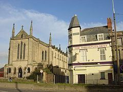
Landmarks in Vauxhall
Much of the area's landmarks have long since been demolished or closed. Some existing landmarks are:
The North Liverpool Community Justice Centre (CJC) was based in Boundary Street in a former school.
For the future, Peel Holdings have proposed a plan for the docks in Vauxhall called Liverpool Waters. However it is reported this development would take decades to complete.
Education
There were many schools in the "Scottie Road" area, however with a decline in population, and rather like pubs and churches, few remain: