Discharge 328 m³/s Country Russia | Basin area 61,800 km² | |
 | ||
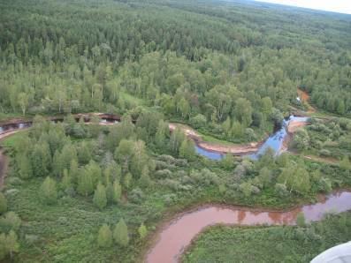
Vasyugan (Russian: Васюга́н) is a river in the southern West Siberian Plain of Russia. It is a tributary of the Ob River on the left side, and its course from its source in the Vasyugan Swamp is entirely within the Kargasok district of Tomsk Oblast.
Contents
Map of r. Vasyugan, Tomsk Oblast, Russia
Statistics
The river is 1,082 kilometres (672 mi) long and is navigable upriver for 886 kilometres (551 mi) from the mouth. The Vasyugan drains a basin of 61,800 square kilometres (23,900 sq mi). Average annual runoff: 345 m³ / c, 10.9 km³ / year.
Tributaries:
Municipalities (downstream from source): pp. New Vasyugan, d. Aypolovo, pp. New Tevriz, pp. Srednii Vasyugan, pp. Old Berezovka, pp. Ust-Chizhapka, pp. Naunak, pp. Most mane, pp. Staro Yugino, pp. Novo Yugino, pp. Bondarko.
Literature
References
Vasyugan River Wikipedia(Text) CC BY-SA
