
Region Amecameca Municipal Status November 9, 1994 Area 46.36 km² Capital Xico | Municipal Seat Xico Population 357,645 (2010) Area code 55 | |
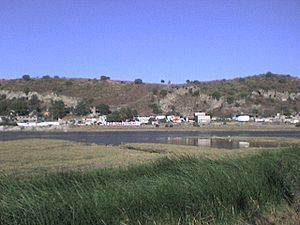 | ||
Valle de Chalco, officially named Valle de Chalco Solidaridad, is a municipality located in the State of Mexico, Mexico, on the eastern outskirts of the metropolitan area of Mexico City. Formerly part of the municipality of Chalco, it was split off as a separate entity in 1994, during the presidency of Salinas de Gortari, under his Programa Nacional de Solidaridad (National Solidarity Program). The municipality lies on the old bed of Lake Chalco, which was substantially drained in the nineteenth century. Technically, the municipal seat is Xico, after a high point of land that once formed an island, and now remains as a small hill within an otherwise monotonous, urban expanse. "Chalco" refers to the Chalca tribe, whose territory covered the area around the lake, prior to the Spanish Conquest of Mexico.
Contents
- Map of Valle de Chalco State of Mexico Mexico
- Pre Columbian history
- Modern history
- Towns and villages
- References
Map of Valle de Chalco, State of Mexico, Mexico
As of 2006, Chalco included part of the world's largest mega-slum, along with Ciudad Nezahualcoyotl and Ixtapaluca.
Pre-Columbian history
Archeologists date human settlement around Lake Chalco from about 2400 B.C, but major settlement occurred at approximately 1240 B.C., when the first tribe to call itself Chalca migrated to the region. This tribe was followed by others, ethnically and linguistically diverse, who added the name Chalca to their own. By 1410 the Chalca territory had developed into a loose confederation, divided into four, semi-sovereign domains. In the early 14th century the Mexica tribe of the Aztecs settled in nearby territory and began to build their city of Tenochitlan, now Mexico City. Over time, the Chalcas and Mexicas engaged in a number of ritual wars, known as Xōchiyaoyōtl or Flower Wars. During the Spanish Conquest of the Aztecs, the Chalca allied themselves with Hernán Cortés and his troops.
Modern history
Under the presidency of Porfirio Díaz, much of the drained lake bed formed part of a latifundia, the Hacienda de Xico. Following the Mexican Revolution, land ownership was reformed into the ejido system of communal ownership, and was utilized primarily for dairy farming by the communal owners, or ejidatarios. This began to change near the end of the 1970s, as hundreds of homesteaders, generally from Mexico City and adjacent urbanized areas, descended upon the region. Most purchased their homestead plots illegally from ejidatarios. The new settlement grew despite the lack of basic infrastructure, such as potable water, sewers, electricity, public transport, medical services and schools. It was only with the initiation of the Programa Nacional de Solidaridad, in 1988, that the federal government began to install basic services and, ultimately, regularize the tenancy of 77,000 homesteads.
During the decades of the 1980s and 1990s, Valle de Chalco expanded dramatically in population; by 1995 the city had 287,073 residents. Growth has since slowed, as undeveloped land becomes less available; in 2005, there were 332,279 residents. By the 2010 census it had grown to 357,645.
Towns and villages
Localities (cities, towns, and villages) are: