
Country Honduras Villages 12 Local time Friday 3:45 PM | Department Lempira Area 81 km² Population 3,747 (2015) | |
 | ||
Weather 31°C, Wind SE at 11 km/h, 33% Humidity | ||
Valladolid is one of the municipalities of the Lempira department of Honduras. It takes about 2.5 hours to travel there and it must be via Santa Rosa de Copán–San Marcos de Ocotepeque–Cololaca–Tambla–Valladolid.
Contents
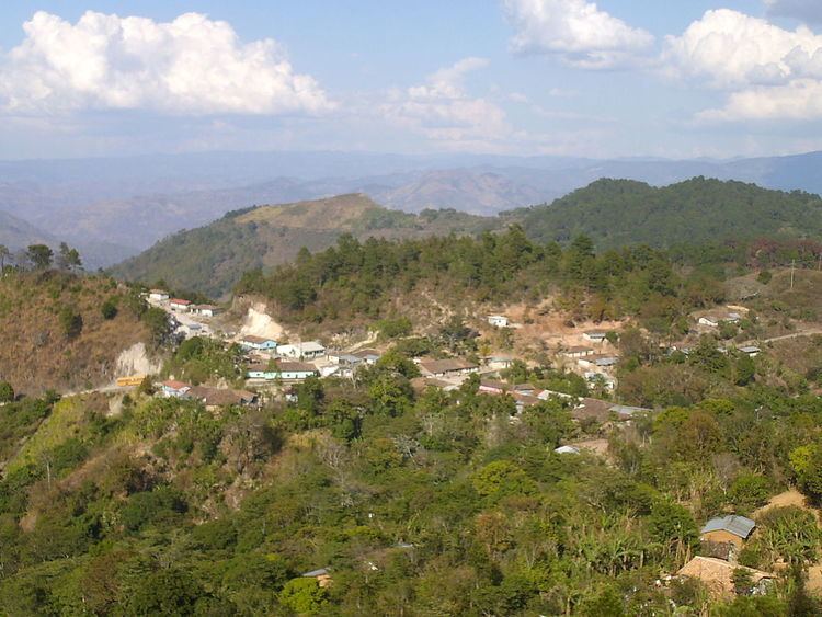
Map of Valladolid, Honduras
History
It was founded in the "Los Patios" village, with the former name of "Colopel", it was later relocated to "Los Naranjos" villages, where it is nowadays; and the name was changed to Valladolid. In the census of 1887 it was registered as a municipality of Guarita district.
Geography
The origin of the rocks and soils in its mountains is totally volcanic. This is clearly seen on the slopes of the road. The municipality capital is on top of a mountain, and there are many pine forest and some sub tropical trees to provide shade to coffee plants. The weather is very cool because of the elevation and the Pine forests.
Boundaries
Its boundaries are:
Population
In Valladolid the cross-breed represents 90% of the population. There are plenty of individuals with white skin.
Tourism
As the traveler approaches the municipality capital they go up a long section, this particular section is very dangerous because there are very deep cliffs. Some curves also need attention. One of the features of this municipality capital is the streets paved with rocks, since they did a very good job. The Pine forests all around give a special touch to the landscapes of the surrounding mountains. The people are very nice and welcoming.