
 | ||
Valiyaparamba backwaters kasaragod kerala
Valiyaparamba is a coastal island in Kasaragod district, Kerala state, India.
Contents
- Valiyaparamba backwaters kasaragod kerala
- Map of Valiyaparamba Kerala 671312
- Backwaters valiyaparamba fishing centre bekal
- Location
- Geography
- Education
- Transportation
- References
Map of Valiyaparamba, Kerala 671312
Backwaters valiyaparamba fishing centre bekal
Location
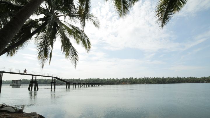
Valiyaparamba is separated from the mainland by Kavvayi Backwater. It is located five kilometres (3.1 mi) southwest of Cheruvathur and about 30 kilometres (19 mi) from Bekal, Kasaragod, north Kerala. The island is approximately 16.14 square kilometres (6.23 sq mi) in size, and had a population of 11,917 in 1991. The island's main source of income is from agriculture and fishing. The island has 13 wards ruling by each ward member to leading the Valiyaparamba Panchayathu.
Geography
Valiyaparamba is fed by four rivers and dotted with numerous little islands. Valiyaparamba, a hinterland separated from the mainland, is a noted fishing centre in the district. A Bekal fort stands on a headland that runs into the sea. The National Water Way passes through the island.
Education
The island has seven primary schools, one high school and one higher secondary school.
Transportation
The island is separated from the mainland and accessible by transport boat service or by crossing the Mavila Kadappuram Bridge.