
Area 18.25 km² Local time Tuesday 12:39 AM | Intercommunality Cœur du Pays Fort Population 806 (1999) | |
 | ||
Weather 9°C, Wind SE at 5 km/h, 71% Humidity | ||
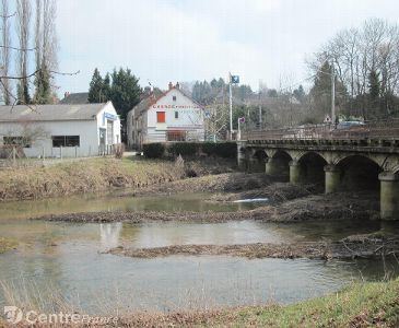
Vailly-sur-Sauldre is a commune in the Cher department in the Centre region of France.
Contents
Map of 18260 Vailly-sur-Sauldre, France
Geography
A farming village situated on the banks of the Sauldre river, about 27 miles (43 km) northeast of Bourges at the junction of the D8 with the D923, D926 and D11 roads.
Sights
References
Vailly-sur-Sauldre Wikipedia(Text) CC BY-SA