
Country Vietnam Capital Vạn Giã Area 550 km² Local time Wednesday 11:19 PM | Region South Central Coast Time zone UTC + 7 (UTC+7) Province Khanh Hoa Province | |
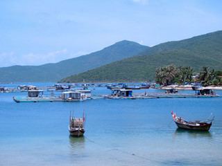 | ||
Weather 19°C, Wind NW at 2 km/h, 90% Humidity Points of interest Hầm đường bộ Đèo Cả, Biển Đại Lãnh, Bãi biển Đại Lãnh, Bãi biển Rạng, Bãi biển Na | ||
Vạn Ninh is a rural district of Khánh Hòa Province in the South Central Coast region of Vietnam.
Contents
- Map of VE1BAA1n Ninh District Khanh Hoa Province Vietnam
- Geography
- Notable people from Vn Ninh
- References
Map of V%E1%BA%A1n Ninh District, Khanh Hoa Province, Vietnam
Geography
Vạn Ninh is the northernmost district of Khánh Hòa. Vạn Ninh has communes from north to south: Đại Lãnh, Vạn Thọ, Vạn Thạnh, Vạn Phước, Vạn Long, Vạn Bình, Vạn Khánh, Vạn Phú, Vạn Lương, Xuân Sơn, Vạn Hưng, Vạn Thắng. It is bordered to the north by Phú Yên Province, and to the south by Ninh Hòa. It contains the easternmost point in mainland Vietnam. East of Vạn Ninh is the Vân Phong bay, East Vietnam Sea, and Pacific Ocean.
As of 2003 the district had a population of 126,805. The district covers an area of 550 km². The district capital lies at Vạn Giã.
Notable people from Vạn Ninh
References
Vạn Ninh District Wikipedia(Text) CC BY-SA