
Existed: 1945 – present | Constructed 1945 | |
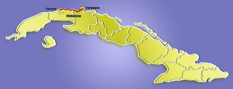 | ||
Vía Blanca is a highway in northern Cuba, connecting the capital city of Havana and the city of Matanzas. A second section extends eastwards from Matanzas to the tourist town of Varadero.
Contents
Map of V%C3%ADa Blanca, Cuba
Overview
It is mostly a four lane highway, with some divided sections. It runs east-west for 85 km between Havana and Matanzas, crossing the town of Santa Cruz del Norte, and an additional 53 km east to Varadero, at the northern tip of Peninsula de Hicacos (the section between Matanzas and Varadero is a toll road). Most of the highway runs along the Straits of Florida shoreline. This is one of the busiest highways in Cuba, as it joins the two tourist destinations of Havana and Varadero.
Construction of the highway begun in 1945; the bridge of Bacunayagua, on the Mayabeque/Matanzas province border, was completed in 1960. This is the highest bridge in Cuba.
Route description
The Via Blanca starts at the Ciudad Deportiva on the south-western side of Havana and runs through the southern suburbs of the city before crossing the Via Monumental in Habana del Este. From west to east, the Via Blanca then passes: