Local time Monday 6:19 PM | District town Uyar | |
 | ||
Municipal district Uyarsky Municipal District Weather 1°C, Wind W at 6 km/h, 29% Humidity | ||
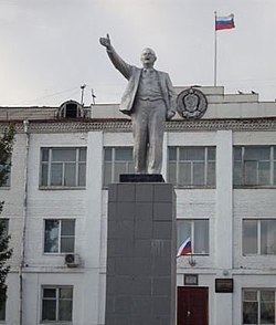
Uyar (Russian: Уяр) is a town and the administrative center of Uyarsky District of Krasnoyarsk Krai, Russia, located on the Uyarka River (Yenisei's basin) 132 kilometers (82 mi) east of Krasnoyarsk. Population: 12,665 (2010 Census); 13,807 (2002 Census); 17,040 (1989 Census).
Contents
Map of Uyar, Krasnoyarsk Krai, Russia
History
It has been known to exist since 1760. In the 19th century, the Trans-Siberian Railway was laid right through the settlement and a small railway station, known as Klyukvennaya (Клюквенная), was also built there. It was there that during the Russian Civil War the Polish 5th Rifle Division capitulated to the Bolsheviks in the course of the White Retreat from Siberia. Town status was granted in 1944.
Administrative and municipal status
Within the framework of administrative divisions, Uyar serves as the administrative center of Uyarsky District. As an administrative division, it is incorporated within Uyarsky District as the district town of Uyar. As a municipal division, the district town of Uyar is incorporated within Uyarsky Municipal District as Uyar Urban Settlement.
