
Country United States Area code(s) 507 Elevation 358 m Population 288 (2013) | Time zone Central (CST) (UTC-6) FIPS code 27-66424 Zip code 55979 Local time Monday 3:26 AM | |
 | ||
Weather 7°C, Wind SE at 5 km/h, 99% Humidity | ||
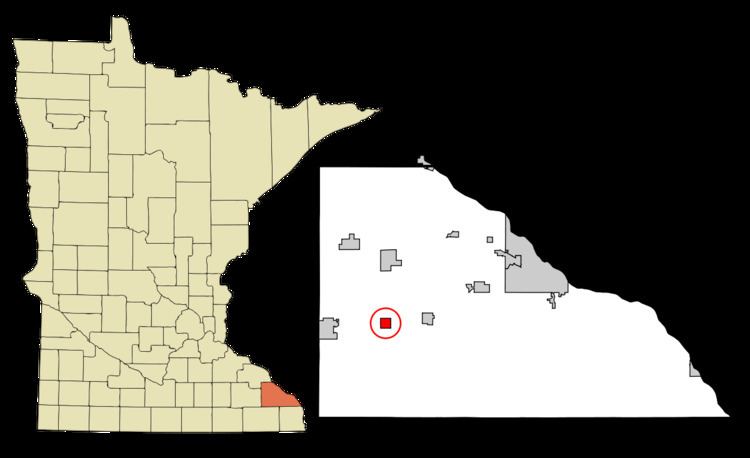
Utica is a city in Winona County, Minnesota, United States. The population was 291 at the 2010 census.
Contents
Map of Utica, MN 55979, USA
History
Utica was platted in 1866. The city was named after Utica, New York.
Geography
According to the United States Census Bureau, the city has a total area of 0.93 square miles (2.41 km2), all of it land.
2010 census
As of the census of 2010, there were 291 people, 105 households, and 71 families residing in the city. The population density was 312.9 inhabitants per square mile (120.8/km2). There were 109 housing units at an average density of 117.2 per square mile (45.3/km2). The racial makeup of the city was 95.9% White, 1.7% Native American, and 2.4% from two or more races. Hispanic or Latino of any race were 3.4% of the population.
There were 105 households of which 33.3% had children under the age of 18 living with them, 58.1% were married couples living together, 5.7% had a female householder with no husband present, 3.8% had a male householder with no wife present, and 32.4% were non-families. 21.0% of all households were made up of individuals and 7.7% had someone living alone who was 65 years of age or older. The average household size was 2.77 and the average family size was 3.31.
The median age in the city was 34.4 years. 27.8% of residents were under the age of 18; 7.9% were between the ages of 18 and 24; 27.5% were from 25 to 44; 27.8% were from 45 to 64; and 8.9% were 65 years of age or older. The gender makeup of the city was 53.6% male and 46.4% female.
2000 census
As of the census of 2000, there were 230 people, 82 households, and 62 families residing in the city. The population density was 250.1 people per square mile (96.5/km²). There were 85 housing units at an average density of 92.4 per square mile (35.7/km²). The racial makeup of the city was 96.96% White, 0.87% Asian, 1.30% from other races, and 0.87% from two or more races. Hispanic or Latino of any race were 7.83% of the population.
There were 82 households out of which 41.5% had children under the age of 18 living with them, 63.4% were married couples living together, 11.0% had a female householder with no husband present, and 23.2% were non-families. 19.5% of all households were made up of individuals and 4.9% had someone living alone who was 65 years of age or older. The average household size was 2.76 and the average family size was 3.17.
In the city, the population was spread out with 29.6% under the age of 18, 10.0% from 18 to 24, 31.3% from 25 to 44, 18.3% from 45 to 64, and 10.9% who were 65 years of age or older. The median age was 32 years. For every 100 females there were 101.8 males. For every 100 females age 18 and over, there were 102.5 males.
The median income for a household in the city was $43,250, and the median income for a family was $44,286. Males had a median income of $30,500 versus $20,625 for females. The per capita income for the city was $19,185. About 3.3% of families and 3.8% of the population were below the poverty line, including none of those under the age of eighteen and 10.3% of those sixty five or over.
Education
Utica is part of the St. Charles School District.