
Country Thailand Muban 107 Postal code 13210 Population 39,943 (2000) | Seat Uthai Time zone ICT (UTC+7) Area 186.8 km² Geocode 1414 | |
 | ||
Province Phra Nakhon Si Ayutthaya Province | ||
Relief operation in uthai district ayutthaya
Uthai (Thai: อุทัย; [ʔù.tʰāj]) is a district (amphoe) in the eastern part of Ayutthaya Province, in Thailand.
Contents
- Relief operation in uthai district ayutthaya
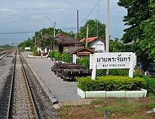
- Map of Uthai District Phra Nakhon Si Ayutthaya Thailand
- History
- Geography
- Administration
- References
Map of Uthai District, Phra Nakhon Si Ayutthaya, Thailand
History
Historically, the district was named Uthai Yai, but was renamed Uthai in 1916.
Before the Ayutthaya kingdom was conquered by Burmese troops in 1767, Phraya Wachira Prakan (the later king Taksin) led his small group of soldiers against the Burmese troops to the east. He passed the Burmese troops and arrived at the territory in the morning. Then he named this area Uthai, which mean "risen sun".
Geography
Neighboring districts are (from the north clockwise) Nakhon Luang and Phachi of Ayutthaya Province, Nong Khae of Saraburi Province, Wang Noi, Bang Pa-in and Phra Nakhon Si Ayutthaya of Ayutthaya again.
Administration
The district is divided into 11 sub-districts tambon, which are further subdivided into 107 villages muban. Uthai is a township (thesaban tambon) covering parts of the tambon Uthai.