
Existed: 1933 – present Length 88.1 km | Constructed 1933 | |
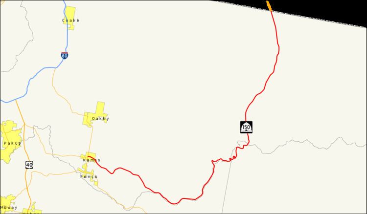 | ||
North end: WYO 150 near Evanston, WY | ||
State Route 150, also known as the Mirror Lake Highway, is a state highway in the U.S. state of Utah. It is named for Mirror Lake, a picturesque lake that the highway passes along the way. It is also a USDA Forest Service Byway.
Contents
Map of UT-150, United States
Route description
The highway begins at the intersection of Main Street (SR-32) and Center Street in Kamas and heads east on the latter as a two-lane undivided highway. Once exiting Kamas, the route dips southeast and continues as such until reaching Samak, where the road turns northeast briefly. Soon after, the highway turns south and southeast again. After continuing in a general southeast direction, the highway turns northeast and north and continues as such until reaching the Wyoming border south of Evanston.
The road is the highest paved road in Utah when it crosses Bald Mountain Pass at an altitude of 10,715 ft (3,266 m).
During the winter months the road is closed to automobiles and is used by snowmobiles.
History
The state legislature designated SR-150 in 1933, running east from SR-35 (now SR-32) in Kamas to the Wasatch-Cache National Forest boundary. In 1953, it was extended east and north via Mirror Lake to the Wyoming state line.