
Population 2,546 (30 Sep 2016) | Area 190.9 km² Local time Monday 12:49 PM | |
 | ||
Time zone Japan Standard Time (UTC+9) Website www.town.uryu.hokkaido.jp Weather 8°C, Wind W at 14 km/h, 38% Humidity | ||
Uryū (雨竜町, Uryū-chō) is a town located in Uryū District, Sorachi Subprefecture, Hokkaido, Japan.
Contents
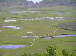
Map of Uryu, Uryu District, Hokkaido Prefecture, Japan
As of 2016, the town has an estimated population of 2,546 and a density of 13.3 persons per km². The total area is 190.91 square kilometres (73.71 sq mi).
Etymology
The name of the town is from the Ainu language, but the origin of name has been lost. Urir-o-pet, one possibility, means "cormorant river".
In the Japanese language the name of the town is written with ateji, or kanji characters used to phonetically represent native or borrowed words. The first, 雨, means "rain", and the second, 竜, means "dragon".
Neighboring municipalities
References
Uryū, Hokkaido Wikipedia(Text) CC BY-SA