Country China Area 14,577 km2 | Region Xinjiang Mayor Jerla Isamudin (???·???? (zh) / ???????? ?????????) | |
Colleges and Universities Xinjiang University, Xinjiang Medical University, Xinjiang Agricultural University, Xinjiang University of Finance and Economics, Xinjiang Arts Institute | ||
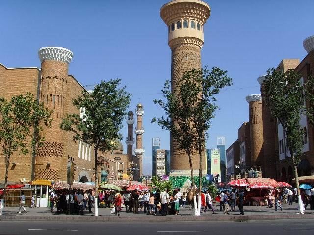
Urumqi ( literally "beautiful pasture", from Mongolian), is the capital of Xinjiang Uyghur Autonomous Region of the Peoples Republic of China in Northwest China. Urumqi was a major hub on the Silk Road during Chinas Tang dynasty, and developed its reputation as a leading cultural and commercial center during the Qing dynasty.
Contents
- Map of Urumqi
- Urumqi walking tour uyghur culture in xinjiangs capital
- History
- Geography
- Economy
- Tourism
- Xinjiang urumqi halal food festival
- References
Map of Urumqi
With a built-up (or metro) population of 2,988,715 as of 2010 census (6 urban and suburban districts but Dabancheng not yet urbanized) and 3.03 million in 7 urban and suburban districts, Urumqi is the largest city in Chinas western interior. Since the 1990s Urumqi has developed economically and now serves as a regional transport node, cultural, and commercial centre.
Urumqi walking tour uyghur culture in xinjiangs capital
History
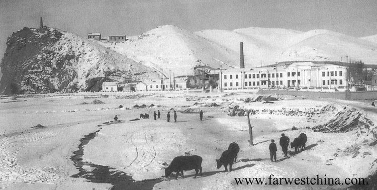
Although Urumqi is situated near the northern route of the Silk Road, it is a relatively young city. According to Chinese scholars, during the 22nd year of Emperor Taizongs reign in the Tang dynasty, AD 648, the Tang government set up the town of Luntai in the ancient town seat of Urabo, 10 kilometres (6 miles) from the southern suburb of present-day Urumqi. Ancient Luntai Town was a seat of local government, and collected taxes from the caravans along the northern route of the Silk Road.
Steppe peoples had used the location, the pass between the Bogda Shan to the east and the Tian Shan to the west, connecting the Dzungar Basin to the north and the Turpan Depression to the south. In the 7th century the location was controlled by tribes of the Gokturks (Turkic Khaganate). In 742 AD, the Gokturk Khaganate split as the Uyghur tribes and the Eastern "wing" of the Gokturks broke off to form the Uyghur Khaganate. Urumqi lay in the center of this empire until 1220, when it merged with the Mongol Empire under Genghis Khan. After the division of the Mongol Empire, the town then passed into the Chagatai Khanate (also Turkic) where Sufi Islam dominated Urumqi culture. Around 1670 the Uyghur tribes revolted from the Chagatai Turks and united with the Dzungar tribes to form Zunghar Khanate. Urumqi remained a small town, and less important than the oasis and Silk Road trade center Turpan 200 km (120 mi) to the southeast.
Thus, little is heard of the region following the Tang dynasty in the Chinese texts until Chinas Qing dynasty vanquished the Dzungar Khanate to the west in the Zunghar genocide. One writer, Wei Yuan, described the resulting desolation in what became northern Xinjiang as: "an empty plain for a thousand li, with no trace of man." After 1759 state farms were established, "especially in the vicinity of Urumchi, where there was fertile, well-watered land and few people." By 1762, more than 500 shops were opened by Chinese migrants to the area of modern-day Urumqi. In 1763, the Qianlong Emperor named the expanded town of Luntai "Dihua" (Chinese: ; pinyin: ; Manchu: Wen de dahabure fu), meaning "to enlighten." Dihua quickly became Xinjiangs commercial and financial center, boasting many statues also to Guandi, or the Chinese god of war.
Demographically, Dihua was populated with Chinese Muslims from Gansu and Shaanxi, Han Chinese from all over China, and ethnically diverse Bannermen, which included Manchus. Professor of Chinese and Central Asian History at Georgetown University, James A. Millward wrote that foreigners often mistakenly think that Urumqi was originally a Uyghur city and that the Chinese destroyed its Uyghur character and culture, however, Urumqi was founded as a Chinese city by Han and Hui (Tungans), and it is the Uyghurs who are new to the city. Those Qing literati who visited Dihua were impressed by its cultural sophistication and similarity to eastern China. The writer Ji Xiaolan compared Dihua to Beijing, in that both had numerous wine shops which offered daily performances of Chinese music and dance. The origin of Hui in Urumqi is often indicated by the names of their Mosques.
The Battle of Urumqi (1870) took place in 1870 between the Turkic Muslim forces of Yaqub Beg against the Dungan Muslim forces of Tuo Ming (Daud Khalifa). With the help of Xu Xuegongs Han Chinese militia, Yaqub Begs forces defeated the Dungans. In 1884, the Guangxu Emperor established Xinjiang as a Province, with Dihua as its capital.
During the Kumul Rebellion the Battle of Urumqi (1933) and the Battle of Urumqi (1933–34) took place between the forces of Ma Zhongyings 36th Division (National Revolutionary Army) and Jin Shuren and Sheng Shicais provincial forces. At the second battle Ma was assisted by the Han Chinese General Zhang Peiyuan.
Following the founding of the Peoples Republic of China, on 1 February 1954, the city was renamed Urumqi, meaning "beautiful pasture" in the Mongolian language of the Dzungar people.
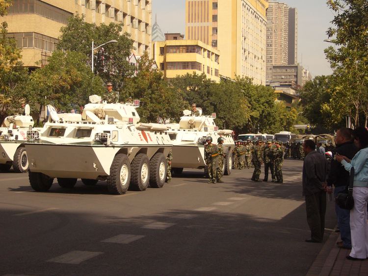
The city suffered unrest in May 1989 with 150 injuries, and was the site of major rioting in July 2009 triggered by violence in Southern China between ethnic Han Chinese and Southern Xinjiang Uyghurs. Official reports of the 2009 riots say that nearly 200 people were left dead, but the actual toll is unknown and disputed. Reports of extensive retaliation against the Uyghur minority have circulated ever since, despite the Chinese government having shut down access to emails and overseas phone calls for over ten months.
Geography
The largest city in western China, Urumqi has earned a place in the Guinness Book of Records as the most remote city from any sea in the world. It is about 2,500 kilometres (1,600 mi) from the nearest coastline as Urumqi is the closest major city to the Eurasian pole of inaccessibility, although Karamay and Altay, both in Xinjiang, are closer. The city has an administrative area of 10,989 square kilometres (4,243 sq mi) and has an average elevation of 800 metres (2,600 ft).
The location 43°40?52?N 87°19?52?E in the southwestern suburbs of Urumqi (Urumqi County) was designated by local geography experts as the "center point of Asia" in 1992, and a monument to this effect was erected there in the 1990s. The site is a local tourist attraction.
Economy
Urumqi is a major industrial center within Xinjiang. Urumqi, together with Karamay and Korla, account for 64.5 percent of the total industrial output of Xinjiang. Urumqi is also the largest consumer center in the region, recording ¥41.9 billion retail sales of consumer goods in 2008, an increase of 26 percent from 2007. The GDP per capita reached US$6,222 in 2008. According to statistics, Urumqi ranked 7th in 2008 by the disposable income for urban residents among cities in Western China. Urumqi has been a central developmental target for the China Western Development project that the Central Government is pursuing.
Tourism