
Zip code 43351 Mayor Scott Washburn | Population 6,586 (2013) Local time Sunday 2:13 PM | |
 | ||
Weather 12°C, Wind S at 11 km/h, 49% Humidity | ||
Upper Sandoosky was a 19th-century Wyandot town named for its location at the headwaters of the Sandusky River in the United States. This was the primary Wyandot town during the American Revolutionary War (1775–1783), and was sometimes also known as Half-King's Town, after Dunquat, the Wyandot "Half-King". The town and the surrounding settlements, like Captain Pipe's Town, were closely allied with the British at Fort Detroit. During the Sandosky Expedition of 1782, Pennsylvania militiamen sought to destroy the town, but were defeated en route.
Contents
- Map of Upper Sandusky OH 43351 USA
- For sale 16795 county highway 115 upper sandusky ohio 43351
- References
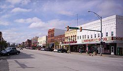
Map of Upper Sandusky, OH 43351, USA
After the war, in September 1783, a number of American Indians met at Upper Sandusky and formed the Western Confederacy, a confederation intended to resist U.S. expansion into the Northwest Territory. The Northwest Indian War followed. Upper Sandusky, Ohio, later developed near the village site.