
Width 24.4 km (15.16 mi) Highest point Palup Qaqa Area 540 km² | Length 30 km (19 mi) Highest elevation 1,903 m (6,243 ft) Elevation 1,903 m Municipality Qaasuitsup | |
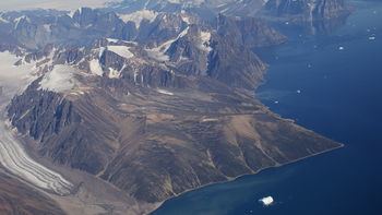 | ||
Upernivik Island (Danish: Upernivik Ø) is an uninhabited island in the Qaasuitsup municipality in northwestern Greenland.
Contents
Map of Upernivik Island, Greenland
Geography
Upernivik Island is located in the Uummannaq Fjord where it is the largest island with an area of 540 km2 (208.5 sq mi).
The island is very mountainous. Its highest point is Palup Qaqaa, an ultra-prominent peak at 71°20′17″N 72°48′17″W reaching 1,903.47 m (6,245.0 ft).
References
Upernivik Island Wikipedia(Text) CC BY-SA