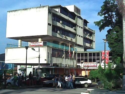
Country Venezuela Municipalities Piar Municipality Elevation 350 m (1,150 ft) Area 1,930 km² Area code 288 | States Bolívar Founded July 7, 1762 Time zone VST (UTC-4:30) Local time Sunday 12:00 PM | |
 | ||
Weather 31°C, Wind E at 19 km/h, 47% Humidity | ||
Upata ([uˈpata]) is a Venezuelan city inside the bulk of Guayana at the north of the Bolívar State. It is the capital and most important town of Piar Municipality. It is located between the basins of the rivers Orinoco and Cuyuní. The name of Upata is an indigenous word, probably of the Kamaracoto ethnic group, means in Spanish “Rose of the mountain” name of an Indian's Thief daughter.
Contents
Map of Upata, Bol%C3%ADvar, Venezuela
Foundation
It is widely known that the first attempts to form the town of Upata came towards 1739. Nevertheless, it was on July 7, 1762 when Fray Antonio de Cervera founded the city with the name of "Village Yocoima of Saint Anthony of Padua" (Villa del Yocoima, de San Antonio de Padua)(Spanish), in honor to the Italian saint from Padua: Saint Anthony of Padua, when the Capucin missionaries brought the Catholic faith to the region.
Human Geography
Upata is one of Venezuela's cities which has a large population of Europeans, many of them from Italy, France, Portugal and Spain. By the years 1945 and 1970 about 1,750 Italians, 650 Portuguese, and many other from Spain. Upata's population comprises 48% Whites, 40% Mestizo, 7% Blacks and 5% of Amerindian descent. In recent times have joined small groups of Asian immigrants, (China, Philippines), dedicated to commercial affairs. Some others from Colombia, Chile, Ecuador, Peru, Bolivia.
Economy
Upata is capital of Piar Municipality in the Bolívar state. Upata is commonly known as a farming and livestock town. The zones near Upata are suitable for raising ranch and the production of bovine meat. The economy of Upata also is sustained in the milk production and the elaboration of one of the Typical and Original Venezuelan cheeses "Queso Telita Guayanes". It also produce international cheeses like ricotta, mozzarella and others of extraordinary quality. Like other food products typical of the region.
Upata also stands out by its natural beauties, among them: The Stone of Santa Maria, El Toro, and the Guacarapo Hills where it has built a giant concrete statue, symbolizing Our Lady of Peace translated into Spanish as "Virgen de la Paz"
Climate
Under the Köppen climate classification Upata has a tropical savanna climate (Aw). Upata is also intertropical, with precipitation that varies between 900 and 1,300 millimeters (35–51 in) (annual), in the city proper, and up to 2,000 millimeters (79 in) in some parts of the Mountain range. Average annual temperatures are 26°C in most of the year. The rains usually begin in November, January and August. Average temperatures are of 19°C to 17°C. The warmest month is August with temperatures of 36°C Max, 26° Min. Recently recorded temperatures of 38°C to 41°C. Also recently, there have been colder nights than normal and hail showers with temperatures of 15°C to 12°C.
