
Country United States FIPS code 26-81420 Area 243 ha Zip code 48767 Local time Friday 3:54 PM | Time zone Eastern (EST) (UTC-5) GNIS feature ID 1615362 Elevation 189 m Population 494 (2013) Area code 989 | |
 | ||
Weather 2°C, Wind N at 29 km/h, 95% Humidity | ||
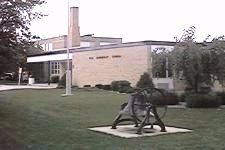
Unionville is a village in Tuscola County in the U.S. state of Michigan. The population was 508 at the 2010 census. The village is located in the northwestern corner of Columbia Township.
Contents
Map of Unionville, MI 48767, USA
Geography
2010 census
As of the census of 2010, there were 508 people, 218 households, and 154 families residing in the village. The population density was 540.4 inhabitants per square mile (208.6/km2). There were 236 housing units at an average density of 251.1 per square mile (97.0/km2). The racial makeup of the village was 97.6% White, 0.2% Asian, 0.8% from other races, and 1.4% from two or more races. Hispanic or Latino of any race were 3.0% of the population.
There were 218 households of which 26.1% had children under the age of 18 living with them, 57.8% were married couples living together, 9.2% had a female householder with no husband present, 3.7% had a male householder with no wife present, and 29.4% were non-families. 27.1% of all households were made up of individuals and 11.1% had someone living alone who was 65 years of age or older. The average household size was 2.33 and the average family size was 2.81.
The median age in the village was 43.6 years. 20.9% of residents were under the age of 18; 6.4% were between the ages of 18 and 24; 24.6% were from 25 to 44; 31% were from 45 to 64; and 17.1% were 65 years of age or older. The gender makeup of the village was 49.2% male and 50.8% female.
2000 census
As of the census of 2000, there were 605 people, 231 households, and 170 families residing in the village. The population density was 652.2 per square mile (251.2/km²). There were 246 housing units at an average density of 265.2 per square mile (102.1/km²). The racial makeup of the village was 97.02% White, 0.83% Asian, 0.33% from other races, and 1.82% from two or more races. Hispanic or Latino of any race were 2.81% of the population.
There were 231 households out of which 37.2% had children under the age of 18 living with them, 58.9% were married couples living together, 11.7% had a female householder with no husband present, and 26.4% were non-families. 22.9% of all households were made up of individuals and 10.0% had someone living alone who was 65 years of age or older. The average household size was 2.62 and the average family size was 3.11.
In the village, the population was spread out with 28.1% under the age of 18, 9.3% from 18 to 24, 27.6% from 25 to 44, 20.8% from 45 to 64, and 14.2% who were 65 years of age or older. The median age was 35 years. For every 100 females there were 93.3 males. For every 100 females age 18 and over, there were 87.5 males.
The median income for a household in the village was $37,500, and the median income for a family was $44,375. Males had a median income of $33,583 versus $21,458 for females. The per capita income for the village was $18,490. About 8.2% of families and 11.8% of the population were below the poverty line, including 26.5% of those under age 18 and 4.7% of those age 65 or over.