
Country United States GNIS feature ID 453913 Local time Friday 1:59 PM | State Indiana FIPS code 18-77246 Elevation 274 m Population 2,838 (2010) | |
 | ||
Weather 8°C, Wind NW at 19 km/h, 92% Humidity Area 76.79 km² (75.99 km² Land / 78 ha Water) | ||
Union Township is one of twelve townships in Delaware County, Indiana. According to the 2010 census, its population was 2,838 and it contained 1,260 housing units.
Contents
- Map of Union Township IN USA
- History
- Geography
- Cities and towns
- Unincorporated towns
- Adjacent townships
- Major highways
- Cemeteries
- References
Map of Union Township, IN, USA
History
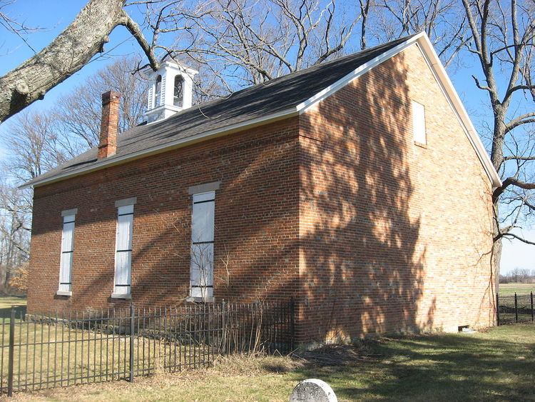
Felt's Farm and the Mount Zion Methodist Episcopal Church are listed on the National Register of Historic Places.
Geography
According to the 2010 census, the township has a total area of 29.65 square miles (76.8 km2), of which 29.34 square miles (76.0 km2) (or 98.95%) is land and 0.3 square miles (0.78 km2) (or 1.01%) is water.
Cities and towns
Unincorporated towns
(This list is based on USGS data and may include former settlements.)
Adjacent townships
Major highways
Cemeteries
The township contains three cemeteries: Leaird, Mount Zion Church and Union.
References
Union Township, Delaware County, Indiana Wikipedia(Text) CC BY-SA