
Population 37,663 (2016) | District Kasuya Local time Friday 1:19 PM | |
 | ||
Time zone Japan Standard Time (UTC+9) Weather 8°C, Wind NE at 26 km/h, 90% Humidity Points of interest Umi Hachiman‑gū, Ōno Castle, Umi Park, Umihachimangu | ||
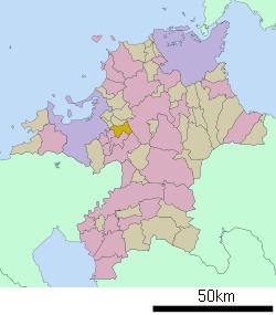
Umi (宇美町, Umi-machi) is a town located in Kasuya District, Fukuoka Prefecture, Japan.
Map of Umi, Kasuya District, Fukuoka Prefecture, Japan
As of 2016, the town has an estimated population of 37,663 and a density of 1,200 persons per km². The total area is 30.22 km².
The town has a river, the Umigawa, flowing through it, a large Hachiman shrine and a small Protestant church. It also has some ancient burial mounds (kofun). It is reputedly the birthplace of Emperor Ōjin, an early Japanese emperor.
A railway was built in 1919 to facilitate the removal of coal, but this local industry ended in 1963. The railway line was closed in 1985 and has been made into a pleasant semi-rural walkway. Umi still has another JR line, the Kashii Line. Ban-dai sake is also made in Umi.
References
Umi, Fukuoka Wikipedia(Text) CC BY-SA