
Country Language spoken Hindi | State District umaria | |
Umaria is a town in umaria district of the Shahdol Division of Madhya Pradesh state of central India.
Contents
- Map of Umaria
- Demographics
- Other places of interest
- Education colleges schools
- Khajuraho jabalpur katni umaria bandhavgarh tour
- History
- Geography
- References
Map of Umaria
Demographics
As of 2001 India census, Umaria had a population of 26,837. Males constitute 53% of the population and females 47%. Umaria has an average literacy rate of 69%, higher than the national average of 59.5%: male literacy is 78%, and female literacy is 59%. In Umaria, 14% of the population is under 6 years of age.
Other places of interest
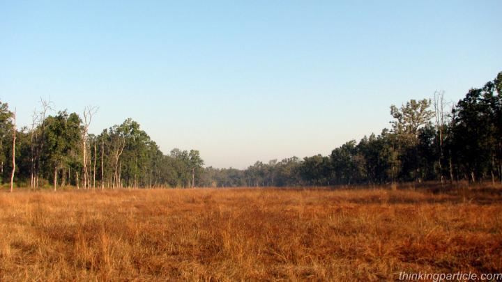
Bandhavgarh National Park : Bandhavgarh National Park is famous for its wild wealth like world famous White tiger.
Bandhavgarh Fort : Bandhavgarh is the name of tehsil in Umaria District. Formerly it was the capital of the Bandhavgarh Kingdom of the Magha dynasty, then the headquarters of the tehsil. At present its headquarters is Umaria. The fort of Bandhavgarh is a place of considerable archaeological and historical importance. It is a natural impregnable fort and stands on a hill, at an attitude of about 2430 metres above sea-level. The Bamnia hill is also a part of the fort, because it is enclosed by a rampart. The fort is on the Rewa-Umaria road, at a distance of about 41 km from Umaria Town.
Manpur Manpur is a block and a biggest Tehsil in umaria district. it is situated on tala-jaisinghnagar road at a distance of something 45km. from umaria and something 12km from bandhavgarh national park..in manpur, a village named CHHAPDAUR is famous for shivpuri aashram which is well known for Santsharan ji maharaj and his religious terms..here a big temple is situated..Manpur is also considered for great schools, civil court, a big market, etc..
Chandia Khas Chandia is situated on the Umaria-Katni road, at a distance of about 21 km. from Umaria. The railway station of Chandia Khas, known as Chandia railway station. The most important spot of Chandia Khas is a small temple, enshrining Goddess Kalika. Her mouth is wide open, but her outstretched tongue is broken. There is also an old temple of god Rama and his consort Janaki. It was the seat of Thakur of Chandia. A small fair meets at Suraswahi Chandia for 3 days in February/March, on the occasion of Shivaratri.
Pali Birsinghpur Pali is situated on the Umaria-Shahdol road, at a distance of about 36 km. from Umaria. Another road goes from Pali to Mandla via Dindori. Pali is also a railway station, and there is a rest house for the tourists to stay. The Station is known as the Pali-Birsinghpur station. Near the railway station there is a temple, enshrining Birasinidevi. By popular belief she is Goddess Kali, represented here as skeleton Goddess, but with her mouth closed. Many remains of old jain idols kept here in some Hindu temples. The annual fairs are held both in October and March, on the occasion of Navaratri, Near the temple of Goddess.
Umaria Town The headquarters town of the Umaria district and Bandhavgarh tehsil, formerly umaria was the headquarters of the South Rewa District. It is situated at a distance of about 69 km from Shahdol. Near the railway station stands a Siva temple, known as the Sagara temple. It was an old shrine, recently remodeled. Its main gates are still intact with beautiful stone statues, carved in Khajuraho models. Near about is Jwalamukhi temple. abut 6.5 km from the town, there is another temple,. with similar carvings of the Khajuraho pattern. It is known as the Manibagh temple.
Umaria is famous for its coal-mines, which were opened in 1881 by the Government of India and transferred to the Rewa Darbar in the same year, mainly to meet the requirement of railway at Katni
Education (colleges & schools)
Khajuraho jabalpur katni umaria bandhavgarh tour
History
Umaria district is located to the North East of Madhya Pradesh. Mathematically the coordinates of the District extend from 23°38 to 24°20 North and 80°28 to 82°12 East. It has geographical area of 4548 km2. The greatest length of the district is about 150 km. from north to south and the greatest width is about 60 km from east to west. The population of the district on the basis of 2001 census is 515963. Out of which about 83% population resides in rural areas. The district has extensive forests. About 42% of the total area is covered by forests only. The District is rich in minerals. The most important mineral found in the district is coal and as a result 8 mines are being
Geography
Umaria is located at 23.42°N 78.63°E? / 23.42; 78.63. It has an average elevation of 538 metres (1765 feet).