
Area 12.52 km² | ||
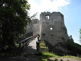 | ||
Uhrovské Podhradie (Hungarian: Zayváralja) is a village and municipality in Bánovce nad Bebravou District in the Trenčín Region of north-western Slovakia. The village is situated close to the ruins of a Roman castle Uhrovec.
Contents
Map of 956 41 Uhrovsk%C3%A9 Podhradie, Slovakia
History
In historical records the village was first mentioned in 1481.
Geography
The municipality lies at an altitude of 340 metres and covers an area of 12.522 km². It has a population of about 46 people.
References
Uhrovské Podhradie Wikipedia(Text) CC BY-SA