
Coat of arms Flag Rural localities 87 Founded 1930 | Selsoviets 18 Area 4,549 km² | |
 | ||
Federal subject Republic of Bashkortostan | ||
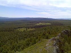
Uchalinsky District (Russian: Учали́нский райо́н; Bashkir: Учалы районы) is an administrative and municipal district (raion), one of the fifty-four in the Republic of Bashkortostan, Russia. It is located in the east of the republic and borders with Chelyabinsk Oblast in the north, east, and south, Abzelilovsky District in the south, and with Beloretsky District in the west. The area of the district is 4,510 square kilometers (1,740 sq mi). Its administrative center is the town of Uchaly (which is not administratively a part of the district). As of the 2010 Census, the total population of the district was 35,480.
Contents
- Map of Uchalinsky District Republic of Bashkortostan Russia
- History
- Administrative and municipal status
- Demographics
- References
Map of Uchalinsky District, Republic of Bashkortostan, Russia
History
The district was established in 1930.
Administrative and municipal status
Within the framework of administrative divisions, Uchalinsky District is one of the fifty-four in the Republic of Bashkortostan. It is divided into eighteen selsoviets, comprising eighty-seven rural localities. The town of Uchaly serves as its administrative center, despite being incorporated separately as a town of republic significance—an administrative unit with the status equal to that of the districts.
As a municipal division, the district is incorporated as Uchalinsky Municipal District, with the town of republic significance of Uchaly being incorporated within it as Uchaly Urban Settlement. Its eighteen selsoviets are incorporated as eighteen rural settlements within the municipal district. The town of Uchaly serves as the administrative center of the municipal district as well.
Demographics
In terms of ethnic composition, as of the 2010 Census 64.3% of the population were Bashkirs, 15.9% were Tatars, and 18.2% were Russians, with 1.6% accounting for other ethnicities.