
Existed: 1926 – 1968 Constructed 1926 | Length 336.4 km | |
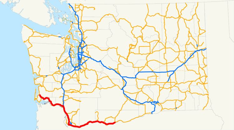 | ||
West end: US 101 / PSH 12 in Johnson's Landing East end: US 97 / PSH 8 in Maryhill | ||
U.S. Route 830, (US 830), was a U.S. Highway which ran between a junction with US 97 near the city of Maryhill, Washington and a junction with US 101 near Ilwaco, Washington. The route still (mostly) exists; however it is currently signed as State Route 14 between Maryhill and Vancouver, Washington, Interstate 5 (I-5) between Vancouver and Longview, State Route 432 for a short stretch through Longview; and State Route 4 from Longview to the western terminus near Ilwaco. The number suggests that US 830 was an auxiliary route of US 30. While US 30 and US 830 never connect, they ran parallel to each other for the entire length of US 830. This route ran on the northern bank of the Columbia River (through Washington) whereas US 30 runs on the river's southern bank, through Oregon.
History
When it existed, US 830 was the highest-numbered route in the U.S. Highway system (and remains the highest U.S. route number ever used). The highest numbered route still in existence is US 730.
The stretch of (former) US 830 which is now I-5 was at one point concurrent with US 99. The stretch of US 830 between Maryhill and Dallesport, Washington was formerly concurrent with US 197; now Dallesport is the northern terminus of US 197.