
SR 19 SR 20 → SR 26 US 27 → | SR 22 US 23 → Length 476.4 km | |
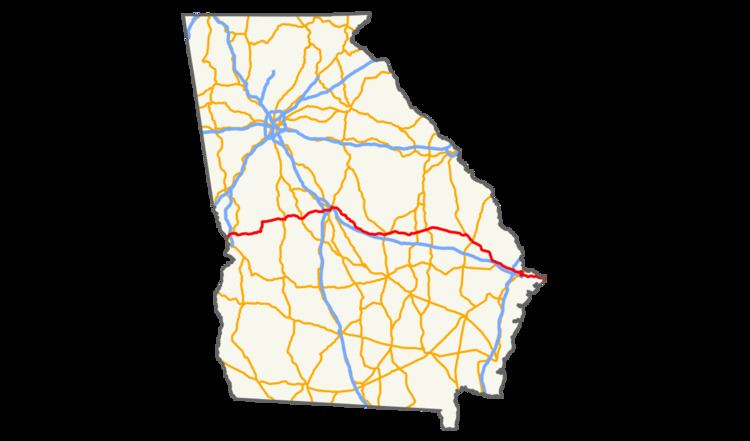 | ||
U.S. Route 80 (US 80) is a 296-mile-long (476 km) U.S. Highway in the U.S. state of Georgia. It travels west-to-east from the Alabama state line in Columbus across the central portion of the state through cities such as Macon, Dublin, Statesboro, and Savannah to connect to its eastern terminus at an intersection with Tybrisa Street and Inlet Avenue in Tybee Island, near the Atlantic Ocean. Here, the roadway continues as Butler Avenue.
In Georgia, all U.S. Highways have at least one state highway that travel concurrently along its route. The main ones that US 80 use are SR 22 from the Alabama state line to Macon; SR 19 from Macon to a point southeast of Montrose; and SR 26 from that point to Tybee Island.
Route description
The highway crosses the Chattahoochee River from Alabama into Columbus where it proceeds along J. R. Allen Parkway through the northern section of the city as a limited-access freeway. Past Columbus, the road meanders through rural Georgia for roughly 50 miles (80 km) en route to Macon where it becomes the Eisenhower Parkway which crosses Interstate 475 and then Interstate 75 before passing through downtown Macon and merging with US 129-BUS 41 in a concurrency. The concurrency with US BUS 41 ends at Poplar Street, and the one with US 129 ends at Riverside Drive. After crossing the Otis Redding Memorial Bridge over the Ocmulgee River, it has another interchange, this time with Interstate 16. The highway joins southbound US 23-ALT 129 and parallels the northern boundary of Ocmulgee National Monument just east of the city.
Beyond Macon, the highway turns southeastward, passing through the cities of Dublin, where it encircles the Laurens County Superior Courthouse. Before the route leaves Dublin, it is joined by US 319/GA 31, where all four routes cross the Herschel Lovett Bridge over the Oconeee River entering East Dublin, where US 319/GA 31 leaves to the northeast. Later it enters Swainsboro, where it overlaps GA 56, and Statesboro where it overlaps US 25, and running roughly parallel to I-16. On the outskirts of Savannah, the highway crosses Interstate 95 and follows Louisville Road into the city's downtown area. After briefly merging with Interstate 516, US-80 continues eastward along Victory Drive, just south of Savannah's historic district. At the community of Thunderbolt, US 80 crosses the Wilmington River and proceeds across the islands and marshes along the Atlantic Coast east of Savannah. There it crosses the Lazaretto Creek onto Tybee Island. The final stretch of US-80 follows Butler Avenue across Tybee Island. The highway terminates at 19th Street, a few hundred feet from the ocean. A small monument at the intersection of Butler and Tybrisa Street marks the end of the highway.