
Country Mexico Mexico Ind. 1821 Municipality Est. 1918 Elevation 36 m | Yucatan Est. 1824 Area 1,289 km² Capital Tzucacab | |
 | ||
Time zone Central Standard Time (UTC-6) | ||
Tzucacab Municipality is one of the 106 subdivisions of the State of Yucatán in Mexico. Its municipal seat is located in the City of Tzucacab.
Contents
Map of Tzucacab Municipality, Yucat%C3%A1n, Mexico
Location
Tzucacab Municipality is located in the southern region of the state and falls between latitudes 19° 38'and 20° 09' north and longitudes 88° 59' and 89° 14' west.
Communities
The municipality is made up of 40 different communities, of which the most important are:
Architectural landmarks
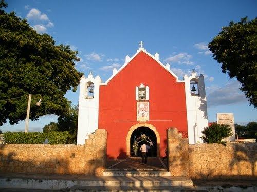
The Church of St. Francis Xavier, located in the municipal seat Tzucacab and dating from the colonial era.
References
Tzucacab Municipality Wikipedia(Text) CC BY-SA